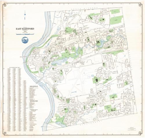
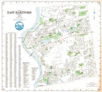
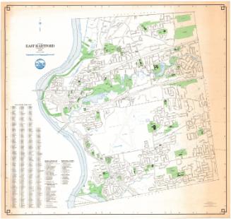
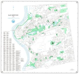
Town of East Hartford, Connecticut
MakerPrepared by the
Metropolitan District Commission
(American, founded 1929)
Date1976
MediumLithography; colored printer's inks on wove paper
DimensionsPrimary Dimensions (image height x width): 30 1/2 x 32in. (77.5 x 81.3cm)
Sheet (height x width): 31 1/2 x 33in. (80 x 83.8cm)
ClassificationsGraphics
Credit LineConnecticut Museum of Culture and History collection
Object number1988.217.0
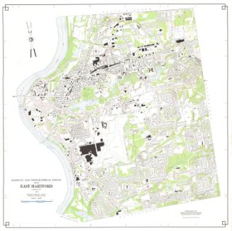
DescriptionMap of East Hartford, Connecticut, from the town line of South Windsor to the north, Manchester to the east, Glastonbury to the south, and the Connecticut River to the west. The local roads are depicted and labeled, and schools, parks, cemeteries, golf courses, and "open spaces" are colored green, with water depicted in blue, including the Hockanum River, Keeney Cove, Porter Brook and several small unnamed bodies of water. To the left of the map are a street index; a list of schools, libraries and other educational facilities; a list of government office; a list of recreational, cultural and historical places; and a miscellaneous list containing the locations of cemeteries, bridges and other open spaces.
Label TextA massive highway interchange dominates this 1976 map of East Hartford, with a tangle of exit and entrance ramps connecting Connecticut Route 2 and Interstate 84 with the Founders and Bulkeley Bridges. Urban renewal in the early 1970s had led to the creation of Founders Plaza, a three-building business office complex overlooking the Connecticut River, creating over ten thousand new jobs, but adding significantly to the traffic problems. During the 1980s and 1990s these problems would be addressed in construction projects that led to improvements to the bridges and the overall traffic flow and increased public access to the river.
NotesCartographic Note: One inch equals 1000 feetStatus
Not on view


Metropolitan District Commission
1972