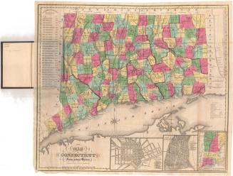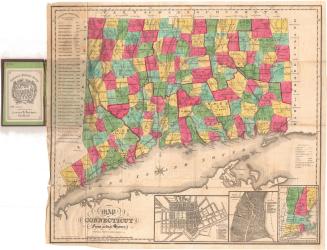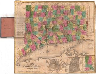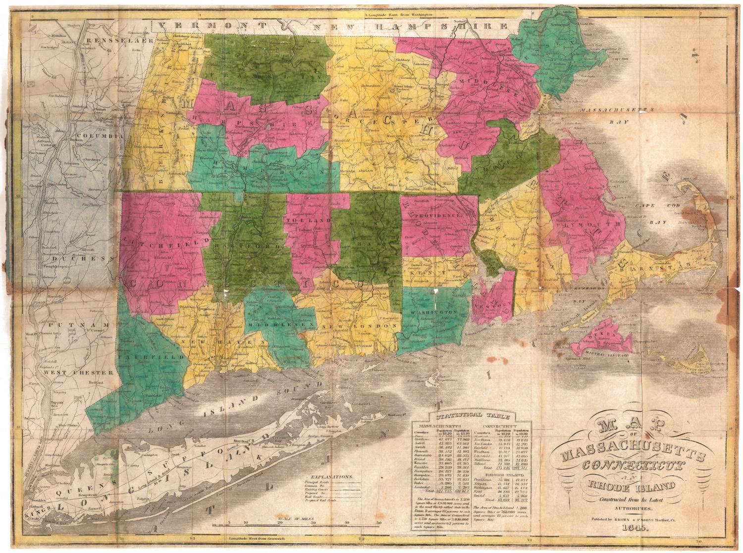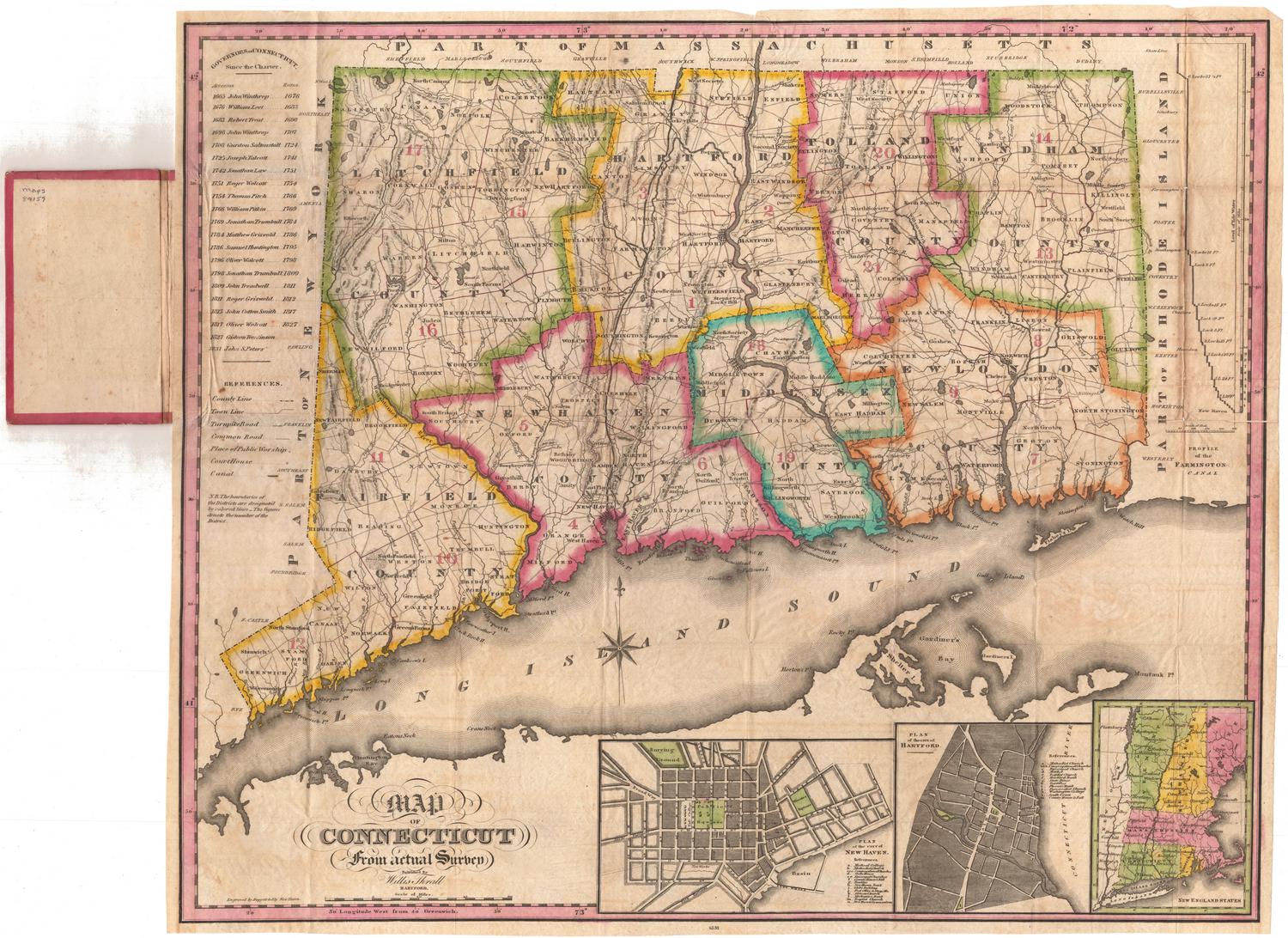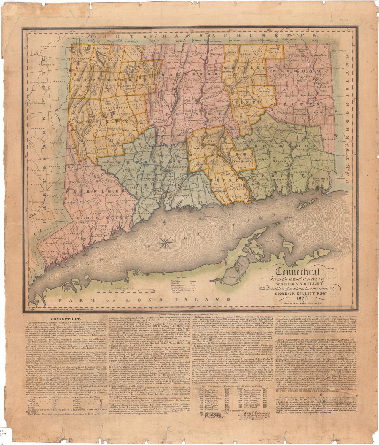
Map of Connecticut from actual Survey
PublisherPublished by
Brown and Parsons
(American, 1838 - 1851)
PrintmakerEngraved by
Daggett & Ely
(American, 1831 - 1836)
Date1847
MediumEngraving; black printer's ink and watercolor on wove paper, in cardboard covers
DimensionsPrimary Dimensions (image height x width): 19 x 21 1/8in. (48.3 x 53.7cm)
Sheet (height x width): 19 1/8 x 21 5/8in. (48.6 x 54.9cm)
ClassificationsGraphics
Credit LineMuseum purchase
Object number1951.37.0
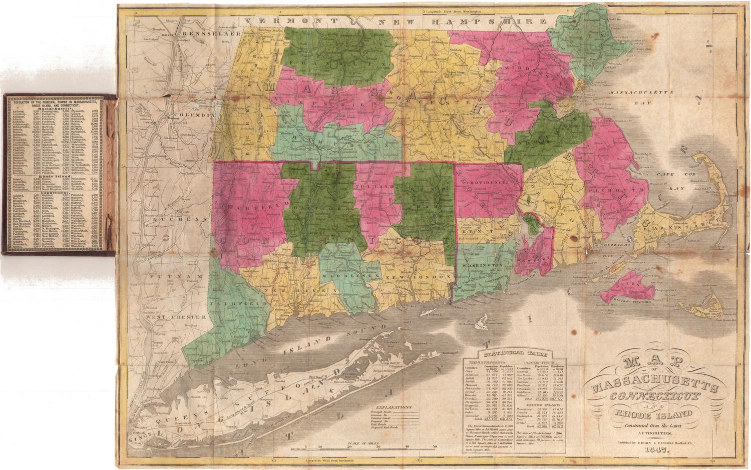
DescriptionPocket map of the state of Connecticut, with part of Massachusetts to the north, part of Rhode Island to the east, part of Long Island and the Long Island Sound to the south, and part of New York to the west. The state is divided into counties, which are outlined in red, and towns, which are colored green, blue, pink, yellow or brown. Physical features include elevation, conveyed with hachure marks, rivers, and ponds/lakes. To the left of the image is a list of the governors of the state from 1665 to 1847. To the right is a profile of the Farmington Canal. At the bottom are inset maps of New Haven, Hartford, and the New England states.
Label TextF. A. Brown and E. W. Parsons were booksellers in Hartford, Connecticut in the mid-nineteenth century. Brown first appeared as the partner of Caleb M. Packard in 1834. Parsons joined the firm in 1837, after Packard retired. The Connecticut Historical Society has five editions of this map published by Brown & Parsons between 1847 and 1851. After Parsons retired in 1851, the firm became Brown & Gross. The Connecticut Historical Society has a later edition of this map published by Brown & Gross in 1858.
NotesCartographic Note: Scale: 1 inch equals almost 5 1/2 milesStatus
Not on view