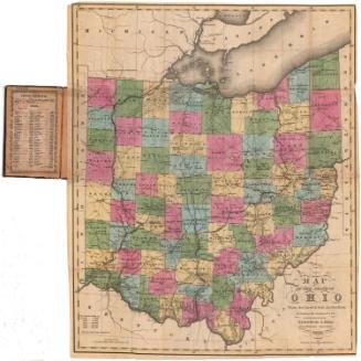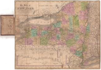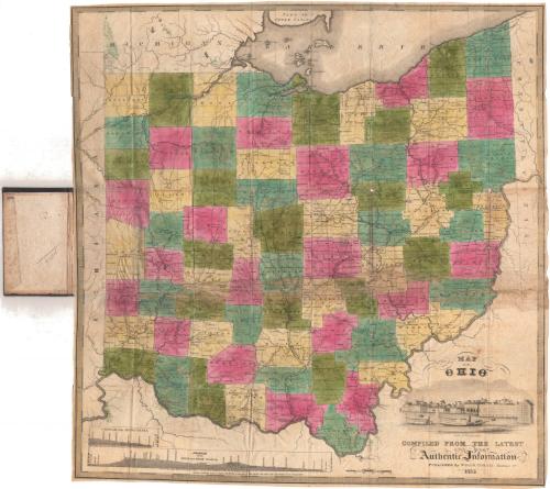
Map of Ohio, Compiled from the Latest and Most Authentic Information
PublisherPublished by
Willis Thrall
(American, 1800 - 1884)
Date1835
MediumEngraving; black printer's ink and watercolor on wove paper, in cardboard covers
DimensionsPrimary Dimensions (image height x width): 22 1/2 x 21 1/2in. (57.2 x 54.6cm)
Sheet (height x width): 22 3/4 x 21 7/8in. (57.8 x 55.6cm)
Sheet (height x width): 22 3/4 x 21 7/8in. (57.8 x 55.6cm)
ClassificationsGraphics
Credit LineMuseum purchase
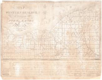
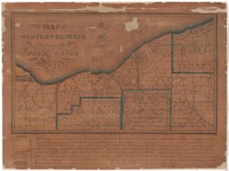
DescriptionMap of the state of Ohio, with part of Michigan and Lake Erie to the north, part of Pennsylvania to the east, the Ohio River to the south, and part of Indiana to the west. The state is divided into townships, which are colored green, blue, pink or yellow. The Miami Canal and the Ohio and Erie Canal are shown (although the Miami Canal is not labeled), and profiles of both appear in the lower left corner. Physical features depicted include rivers and lakes. The cartouche contains a depiction of Cincinnati.
Object number1951.36.0
NotesCartographic Note: Scale: 1 inch equals about 12 milesOn View
Not on view
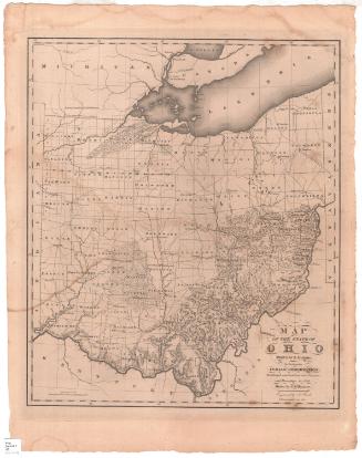
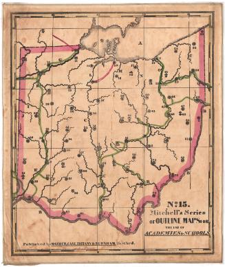
Samuel Augustus Mitchell
1835
Samuel Augustus Mitchell
1834