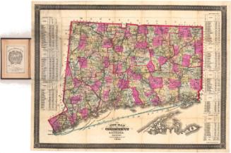
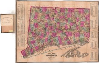
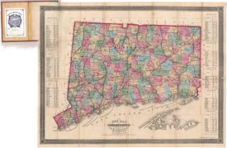
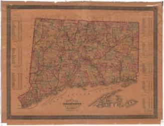
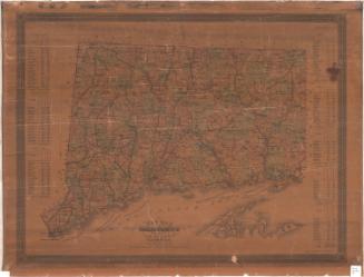
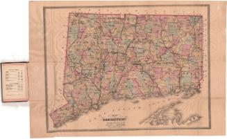
New Map of Connecticut
PublisherPublished by
Samuel D. Tilden
(American, 1828 - 1893)
PrintmakerLithographed by
Bingham & Dodd
(1860 - 1878)
Date1871
MediumLithography; black printer's ink and watercolor on wove paper, lined with linen, in cardboard covers
DimensionsPrimary Dimensions (image height x width): 21 1/4 x 27 7/8in. (54 x 70.8cm)
Sheet (height x width): 22 1/8 x 29 1/8in. (56.2 x 74cm)
Mount (height x width): 22 1/8 x 29 1/8in. (56.2 x 74cm)
Sheet (height x width): 22 1/8 x 29 1/8in. (56.2 x 74cm)
Mount (height x width): 22 1/8 x 29 1/8in. (56.2 x 74cm)
ClassificationsGraphics
Credit LineGift of the Colonial Dames
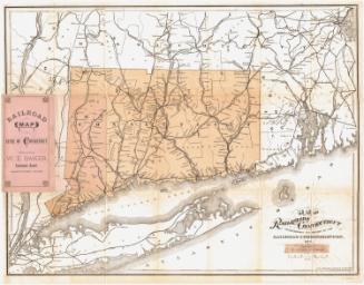
DescriptionPocket map of Connecticut, with the border of Massachusetts to the north, Rhode Island to the east, part of Long Island and the Long Island sound to the south, and New York to the west. The state is divided into counties, outlined in red, and towns, colored pink, green, blue, yellow and peach. Population centers are marked with clusters of black squares. Roads are shown. Railroad lines depicted include the Portchester and Ridgefield; New York, New Haven and Hartford; Housatonic; Danbury and Norwalk; Saugatuck Valley (projected); Shepaug Valley; Boston, Hartford and Erie; New Haven, Middletown and Willimantic/Air Line; Hartford, Providence and Fishkill; New Haven and Northampton; New London Northern; and Norwich and Worcester. The populations of the towns in each county for 1860 and 1870 is listed in statistical tables around main image.
Object number1948.20.1
NotesCartographic Note: Scale: 1 inch equals 4 1/2 milesOn View
Not on view