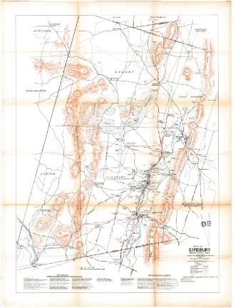
Map Showing Location of Reservoirs in West Hartford
SurveyorSurveyed by
Seth E. Marsh
(American, about 1823 - 1878)
SurveyorSurveyed by
Henry W. Ayres
(American, 1848 - 1912)
MakerMade for the
Hartford Water Company
(American, founded 1851)
Dateafter 1874
MediumDrawing; black ink on wove paper on fabric
DimensionsPrimary Dimensions (image height x width): 40 x 82 1/2in. (101.6 x 209.6cm)
Sheet (height x width): 43 1/2 x 86in. (110.5 x 218.4cm)
Sheet (height x width): 43 1/2 x 86in. (110.5 x 218.4cm)
ClassificationsGraphics
Credit LineConnecticut Museum of Culture and History collection
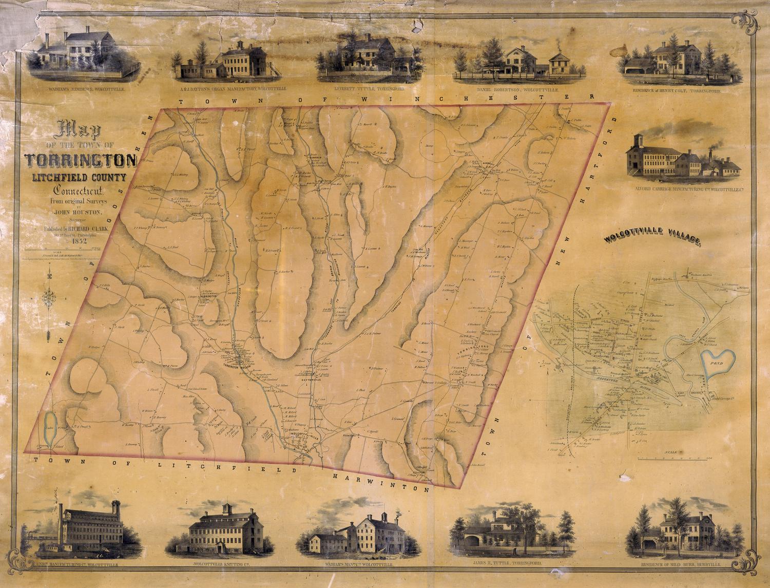
DescriptionMap of a portion of the town of West Hartford showing the location of Reservoirs No. 1, 2, 3, and 5 and surrounding watershed. Names of former property owners and dates when property was acquired by the city of Hartford are shown. Rights of way are shown with names of property owners and dates. Dates range from 1865 to 1880. Other features include the West Hartford Water Works, a waste weir, Mine Brook, Farmington Road (Farmington Avenue), Avon Road, and the former location of a portion of Avon Road. Elevation is shown by hachure marks. A compass rose is at upper right.
Object number1970.27.21
NotesCartographic Note: One inch equals 200 feet
Subject Note: Reservoirs are shown with their original numbers. In the mid-1870s when Reservoir No. 4 was created in Farmington, the West Hartford reservoirs were renumbered as follows: Reservoir No. 1 remained Reservoir 1; Reservoir 2 became Reservoir No. 4; Reservoir 3 became Reservoir No. 2, and Reservoir 4 became No. 3.On View
Not on view