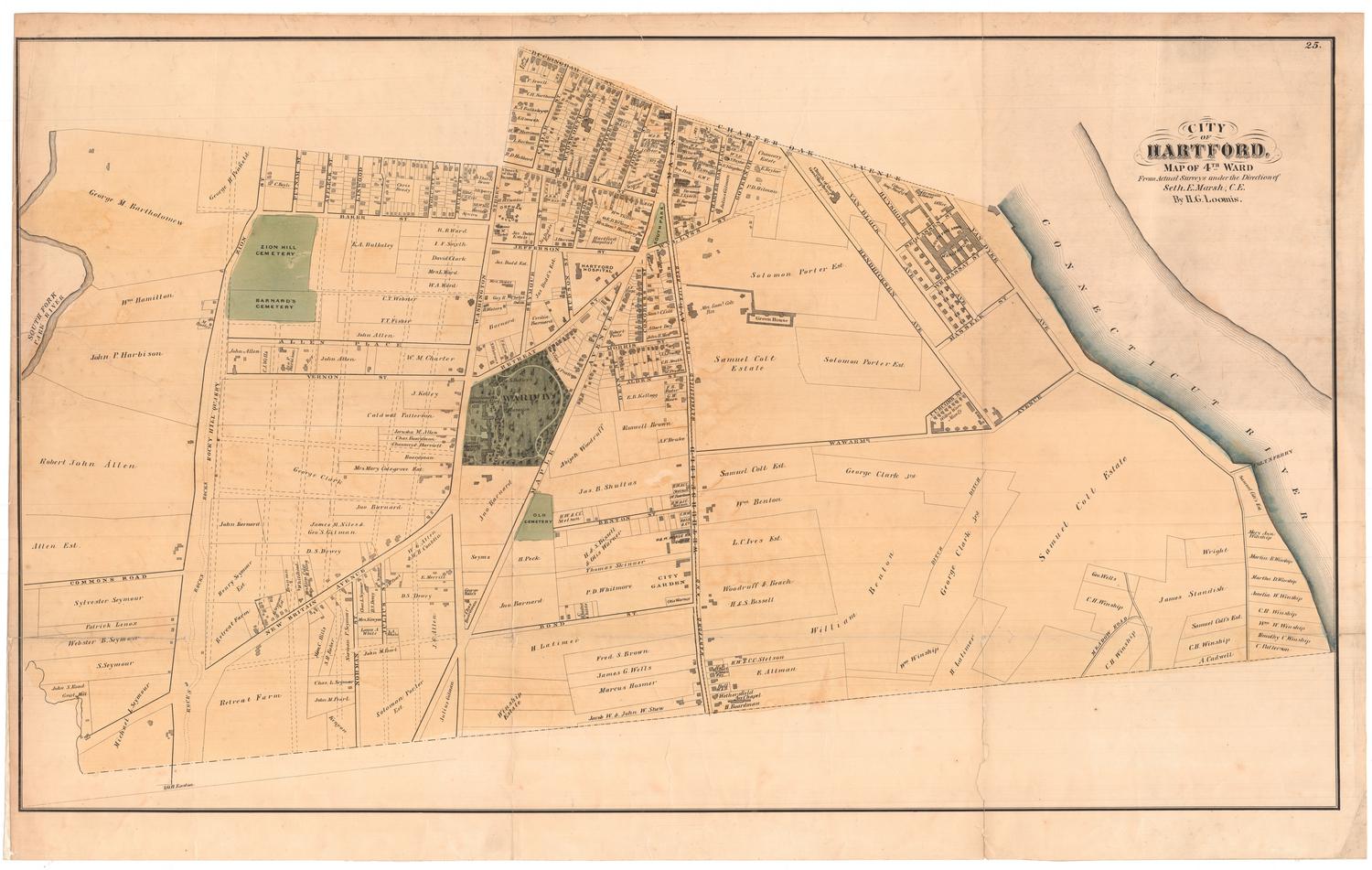
Map of the Fourth Ward, Hartford, Connecticut
MakerMade by
Hartford Water Company
(American, founded 1851)
Date1866
MediumDrawing; black, blue, and red ink on wove paper on fabric
DimensionsPrimary Dimensions (image height x width): 52 1/2 x 88in. (133.4 x 223.5cm)
Sheet (height x width): 54 x 89 1/2in. (137.2 x 227.3cm)
Sheet (height x width): 54 x 89 1/2in. (137.2 x 227.3cm)
ClassificationsGraphics
Credit LineConnecticut Museum of Culture and History collection
DescriptionMap of portion of the city of Hartford, extending from the Connecticut River and the Park River on the east, to Warwarme Avenue on the south, Zion Street on the west, and Charter Oak Avenue on the north. Water pipes, indicated in blue, run along Main Street, John Street, Hudson Street, Wadsworth Street, Cedar Street, and portions of Washington Street and Jefferson Street. Hydrants and stop cocks are indicated. The "Insane Retreat" is the only building shown. An arrow at upper right points to the magnetic meridian.
Object number1970.27.4
NotesCartographic Note: One inch equals 125 feetOn View
Not on view