Railway and Highway Map of the Famous Berkshire Hills Region
DraftsmanDrawn by
Walter Watson
(American, born 1858)
PublisherPublished by
Struthers, Servoss & Co.
(American)
Date1883
MediumLithography; black and colored printer's inks on wove paper
DimensionsPrimary Dimensions (image height x width): 29 1/2 x 22in. (74.9 x 55.9cm)
Sheet (height x width): 31 7/8 x 24in. (81 x 61cm)
ClassificationsGraphics
Credit LineMuseum purchase
Object number1934.28.1
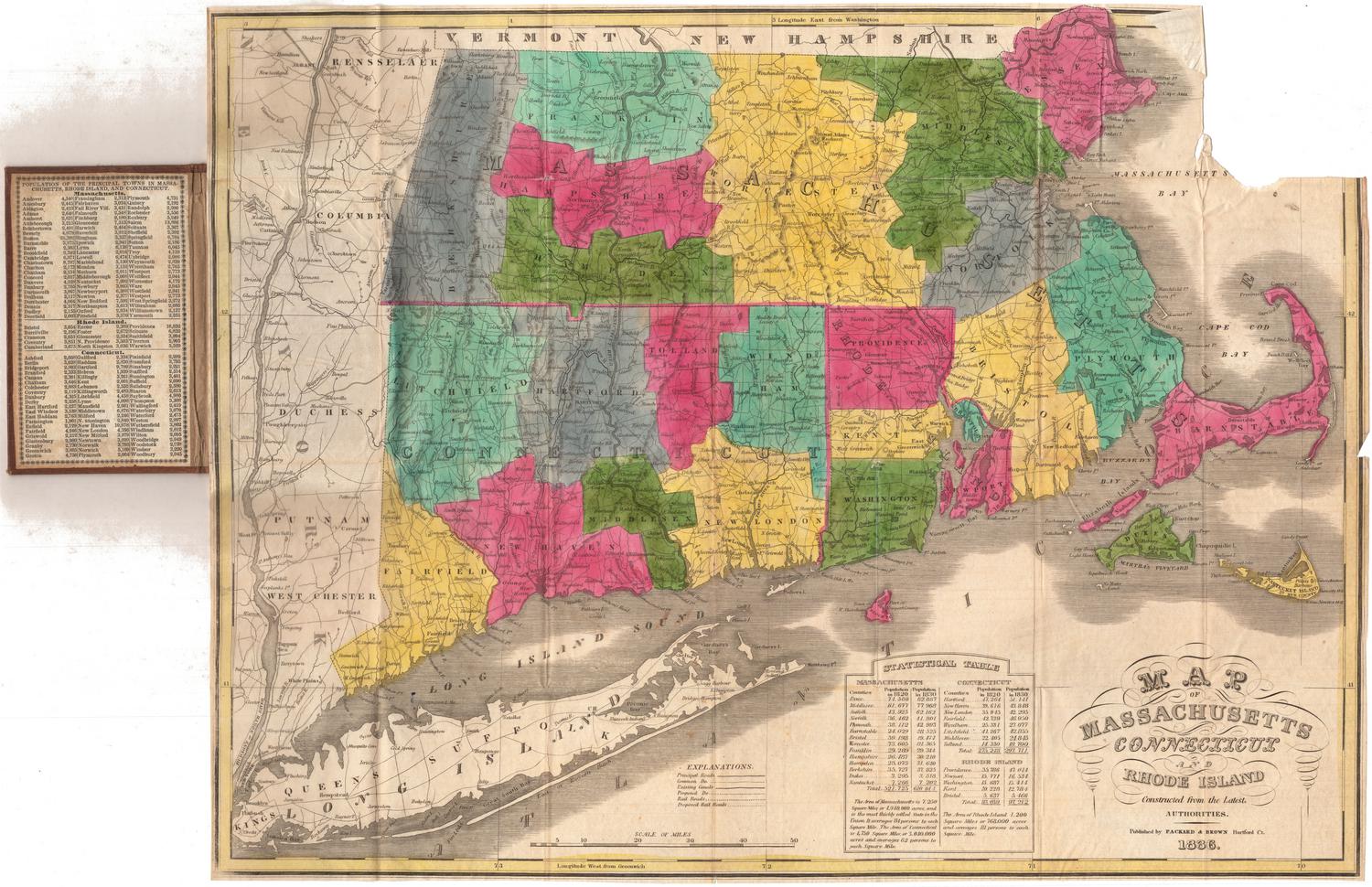
DescriptionPocket map of Berkshire County in western Massachusetts, with part of Vermont to the north, parts of Franklin, Hampshire, and Hampden Counties to the east, part of Connecticut to the south, and part of New York to the west. Berkshire County is colored orange, with towns outlined in a darker shade of the same color. Physical features include elevation, conveyed through hachure marks, and lakes and ponds. Roads and highways are colored red, with railroad lines in black. The railroads shown include the Troy and Greenfield; P & NA; Housatonic; and B & A. In the top right corner is a key. Around the map is text about the Berkshire Life Insurance Company, which is the company that produced the map. On the left side is an image of what is presumably its office. On the lower right side is an image of Greylock Peak in the Berkshires.
Label TextThe Berkshire Life Insurance Company distributed several editions of this map during the 1880s and 1890s, apparently giving them away free to customers as advertising. The Berkshire Hills were a popular tourist resort during this period, with many large hotels and many lavish summer homes built by wealthy summer visitors. This map was clearly intended for the use of tourists traveling by road and railroad.
NotesCartographic Note: Scale: 1 inch equals 2.12 milesStatus
Not on view