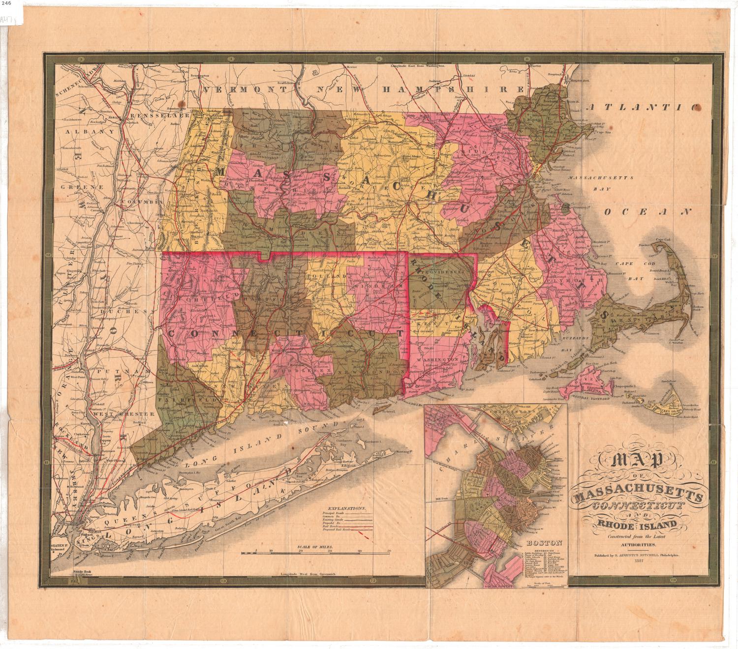
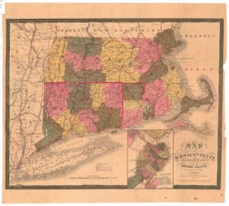
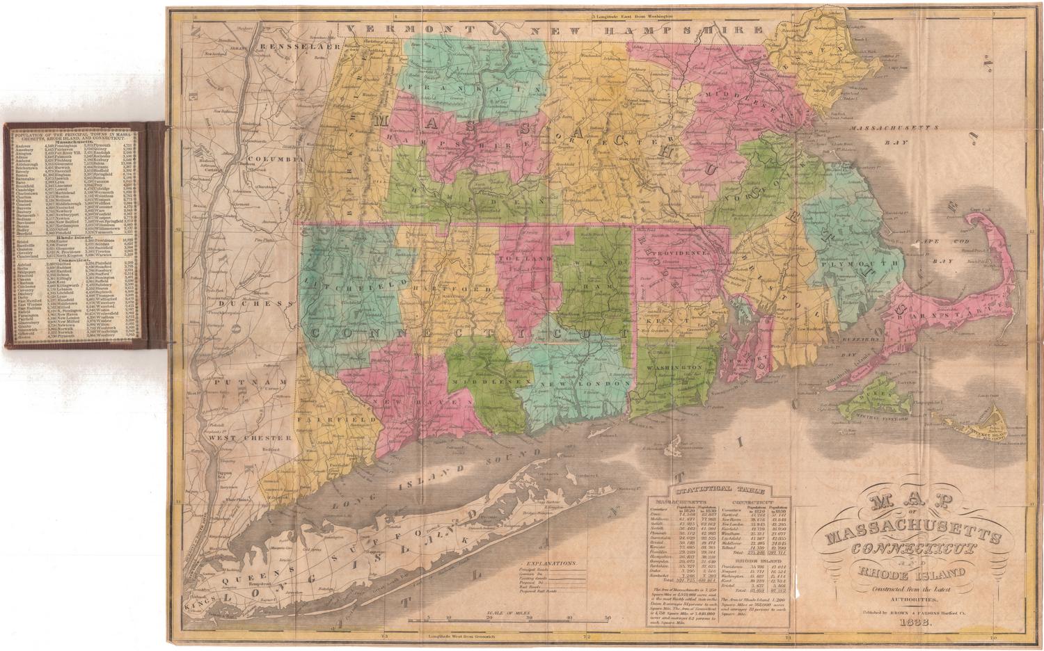
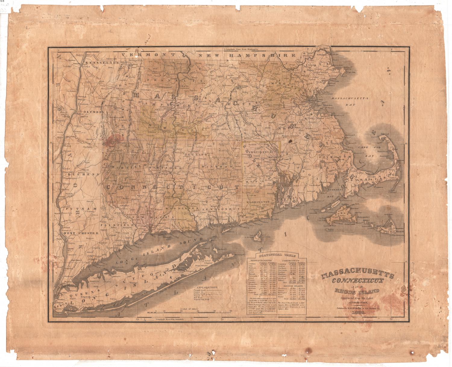
Map of Massachusetts, Connecticut and Rhode Island, Constructed from the Latest Authorities
PublisherPublished by
Brown and Parsons
(American, 1838 - 1851)
Date1847
MediumEngraving; black printer's ink and watercolor on wove paper, in cardboard covers
DimensionsPrimary Dimensions (image height x width): 14 7/8 x 20in. (37.8 x 50.8cm)
Sheet (height x width): 15 x 20 1/8in. (38.1 x 51.1cm)
ClassificationsGraphics
Credit LineGift of Emma Colver
Object number1934.27.1
DescriptionPocket map of Massachusetts, Connecticut and Rhode Island, with parts of Vermont and New Hampshire to the north, the Massachusetts Bay to the east, Long Island and the Long Island Sound to the south, and part of New York to the west. The states are divided into counties, which are colored green, pink or yellow. Main and common roads, existing and proposed canals, and existing and proposed railroads are shown. The Farmington, Hampshire and Hampden, Blackstone, and Middlesex Canals are the existing canals depicted on the map, with one proposed canal between Weymouth and Taunton, Massachusetts. Not all of the existing railroads are labeled on the map. The existing railroads include the Housatonic; Western; the Norwich and Worcester (unnamed); New Haven and Hartford (unnamed); the New York, Providence and Boston (unnamed); the Old Colony; and the Eastern. Various proposed routes appear on the map. Physical features depicted include elevation, conveyed through hachure marks; rivers; and lakes. At the bottom of the sheet is a statistical table containing population information for counties in the three states for 1820 and 1830. The inside front cover also contains population information, for the towns.
Label TextBrown & Parsons were successful Hartford booksellers and stationers, with a shop on Main Street. They also published books and some maps, most of them folding pocket maps printed from plates originally engraved for an atlas published by Anthony Finley in 1826, and later reissued by S. Augustus Mitchell. This pocket map of Massachusetts, Connecticut and Rhode Island must have sold well. Brown & Parsons published earlier editions in 1838 and 1845; this edition is dated 1847. Although they claimed--as map publishers invariably did--that their maps were "constructed from the latest authorities," they do not appear to have updated the plates and many new new towns that were added in the 1830s and 1840s are not included.
NotesCartographic Note: Scale: 1 inch equals about 10 1/2 milesStatus
Not on view


H. F. Sumner & Co.
1833