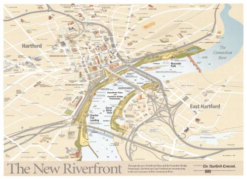
The New Riverfront
DraftsmanDrawn by
Philip Lohman
(American, born 1939)
PublisherPublished by
The Hartford Courant
(American, founded 1764)
Date1999
MediumLithography; colored printer's inks on wove paper
DimensionsPrimary Dimensions (image height x width): 21 x 28 3/4in. (53.3 x 73cm)
Sheet (height x width): 22 x 30in. (55.9 x 76.2cm)
ClassificationsGraphics
Credit LineGift of Phil Lohman
Object number2001.193.0
DescriptionMap of Hartford and East Hartford, Connecticut focusing on the parks and walks along the Connecticut River. These include Riverwalk, Charter Oak Landing, Riverfront Plaza, Founders Bridge Promenade, and Riverside Park in Hartford, and Great River Park and the Hockanum River Linear Trail and Bikeway in East Hartford. Some portions of the Riverwalk are shown as "designed" but "awaiting funding." A "proposed circuit line route" is also shown. Adriaen's Landing is "proposed" but not yet designed or executed. Bridges and highways with exit and entrance ramps surround the green space along the river. Hartford neighborhoods are identified by name: "South Green" "Frog Hollow," etc.
Label TextBy the 1980s, Hartford, like many other American cities was cut off from its waterfront by a maze of highways and exit and entrance ramps. Riverfront Recapture, a non-profit organization founded in 1981, was instrumental in the revitalization of Hartford's and East Hartford's waterfronts along the Connecticut River. By 1999, when this map was issued, great progress had been made. Although designed primarily to celebrate and publicize the new parks and pedestrian walkways and to encourage their use, the map clearly shows access points, and could have served as guide to those wishing to explore the new riverfront.
NotesCartographic Note: No scaleStatus
Not on view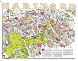

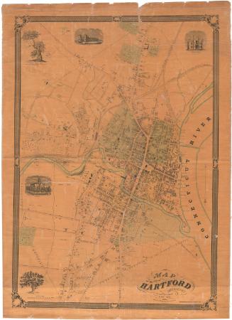
O.H. Bailey and Company

