Property of R. & F. Cheney, Hartford, Conn.
SurveyorSurveyed by
Charles E. Bunce
(American, 1851 - 1910)
DraftsmanDrawn by
Charles E. Bunce
(American, 1851 - 1910)
DateProbably 1875
MediumDrawing; graphite and black ink on wove paper backed with fabric
DimensionsPrimary Dimensions (image height x width): 31 1/2 x 28 3/4in. (80 x 73cm)
Sheet (height x width): 33 1/2 x 31in. (85.1 x 78.7cm)
ClassificationsGraphics
Credit LineGift of Richard Koopman
Object number1987.286.1
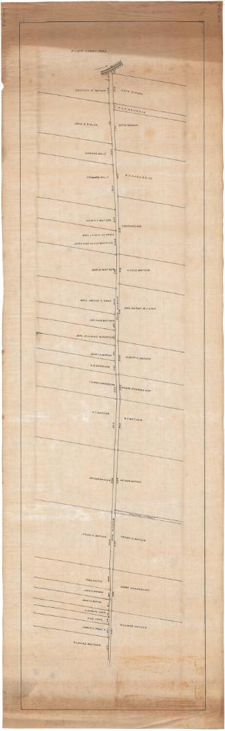
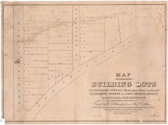
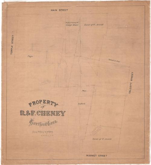
DescriptionPlat map of an area of downtown Hartford, Connecticut, bounded by Main Street on the west, Talcott Street on the north, Market Street on the east, and Temple Street on the south. Names of property owners include Page, May, Bullock, and Talcott & Post. One plot is inscribed "Bought of estate of Mr. George Beach". Two others are inscribed "Estate of E. Averill". Dimensions of the plots are inscribed in pencil and red ink.
Label TextIn the spring of 1875, Rush and Frank Cheney, members of the Manchester, Connecticut silk manufacturing family, purchased property at the corner of Main Street and Temple Street in Hartford. The Bee-Hive, a popular Hartford dry goods store, had long been located on this corner. The Cheneys immediately tore down the existing building, and hired the prominent Boston architect, Henry Hobson Richardson, to design a new store. This map probably shows the site about the time the Cheneys made their purchase. The Cheney building would for many years house Brown, Thomson and Company, one of Hartford's major department stores. Hartford's other great department store, G. Fox and Co., would occupy the corner of Main Street and Talcott Street, also shown on this map.
NotesCartographic Note: One inch equals sixteen feetStatus
Not on view