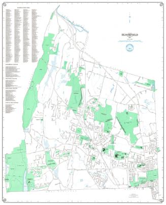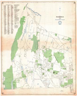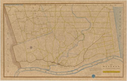
Map of Windsor Showing the Parishes, the Roads and Houses
DraftsmanDrawn by
Harvey T. Maude
(American, 1885 - 1927)
After a work byAfter a work by
Seth Pease
(American, 1774 - 1819)
MakerUnder the direction of
George R. Maude
(American, 1852 - 1926)
Date1906
MediumLithography; printer's ink and watercolor on wove paper
DimensionsPrimary Dimensions (image height x width): 18 5/8 x 30in. (47.3 x 76.2cm)
Sheet (height x width): 20 1/8 x 31 5/8in. (51.1 x 80.3cm)
ClassificationsGraphics
Credit LineConnecticut Museum of Culture and History collection
Object number1996.185.0
DescriptionMap of Windsor, with Granby, Simsbury, and Farmington on the west; Suffield on the north; the Connecticut River on the east; and Hartford on the south. Wintonbury (the future Bloomfield) is shown as a separate parish. The Farmington River is identified as the Windsor River. Houses and other buildings are shown pictorially along the streets with the names of the property owners. A scale of rods and chains is at the lower right. An eight-point compass rose is at the left. The map is oriented with north at the right.
Label TextHarvey T. Maude was studying civil engineering at Rensselaer Polytechnic Institute when he made this copy of an early map of his hometown, Windsor, Connecticut by Seth Pease. Pease was twenty-four years old when he made his original map in 1798. Maude was twenty-one years old when he made his copy in 1906, more than one hundred years later. He evidently obtained access to the old map, which was among the Windsor town records, from his father, George R. Maude, who was the Windsor Town Clerk.
NotesCartographic Note: One inch equals 100 rods; scale also given in chainsStatus
Not on view