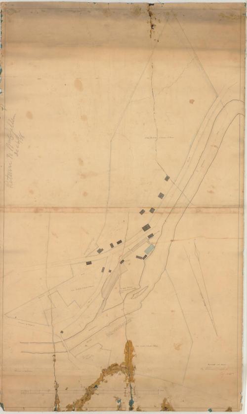
Map of Lower Village, Willimantic, Connecticut
SurveyorSurveyed by
William Lester Jr.
DraftsmanDrawn by
William Lester Jr.
Date1835
MediumDrawing; graphite, black ink, and watercolor on wove paper on fabric
DimensionsPrimary Dimensions (image height x width): 43 3/4 x 26in. (111.1 x 66cm)
Sheet (height x width): 44 3/4 x 27in. (113.7 x 68.6cm)
Sheet (height x width): 44 3/4 x 27in. (113.7 x 68.6cm)
ClassificationsGraphics
Credit LineGift of Mrs. George Nichols
DescriptionPlan of the village of Willimantic on the Willimantic River. Buildings include a sawmill, a paper mill, and a grist mill, and other unidentified buildings. A quarry on the south side of the river, near the Jillson property is inscribed, "This stone is gneiss. It is durable, strong, and / easily dressed, and a beautiful material for / building. It is found here in inexhaustible / quantities." A bridge crosses the river near the quarry. The turnpikes to Hartford and to Middletown are labeled. Another road is labeled "Proposed Road" and another road is labeled "Union Street." Arrows at lower left indicate true north and magnetic north.
Object number1985.212.2
NotesCartographic Note: One inch equals 4 rodsOn View
Not on view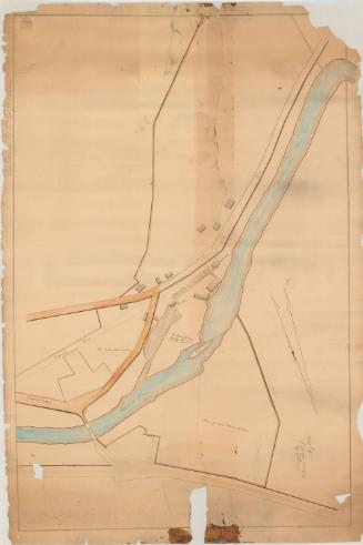

Metropolitan District Commission
1972