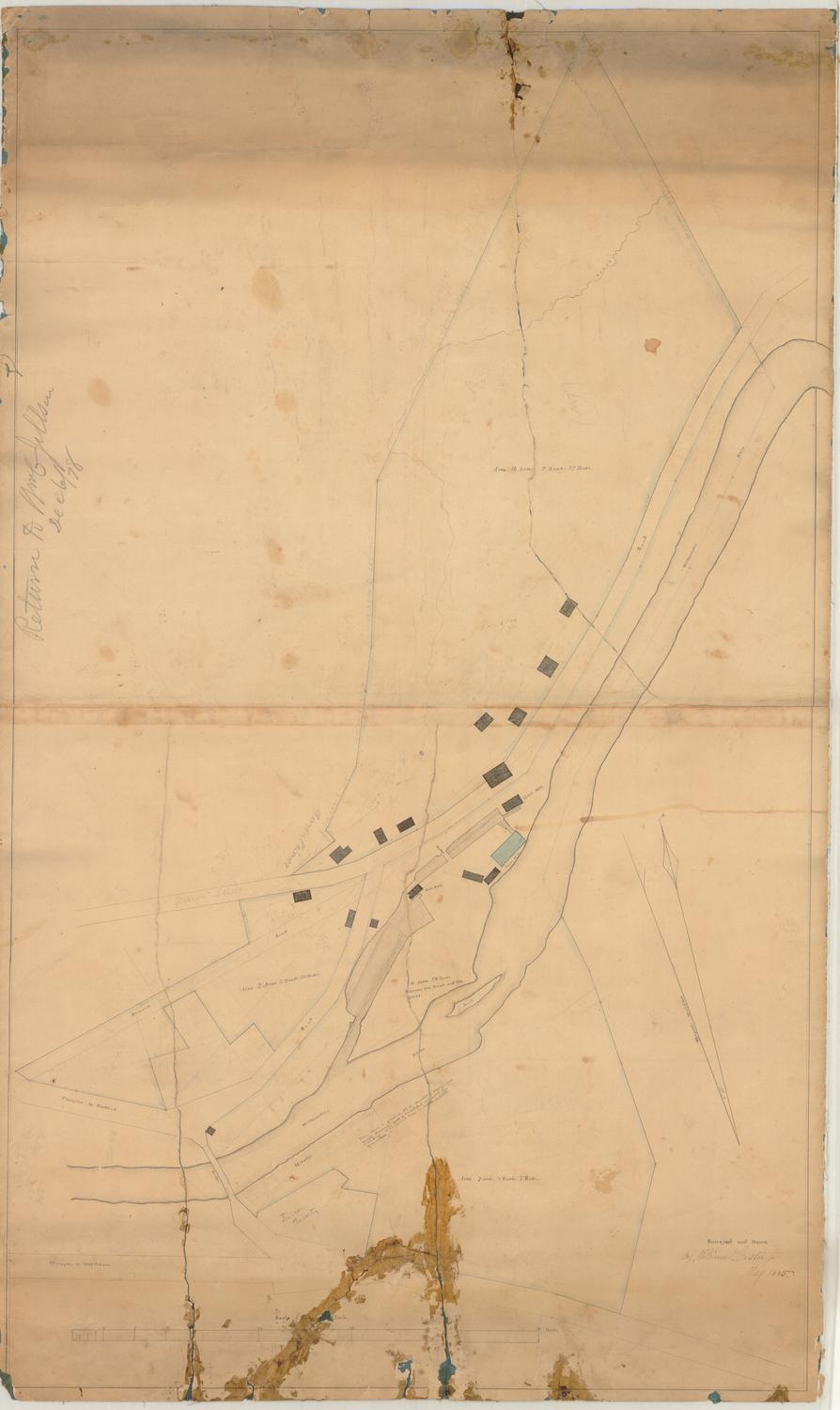
Map of Willimantic, Connecticut
SurveyorSurveyed by
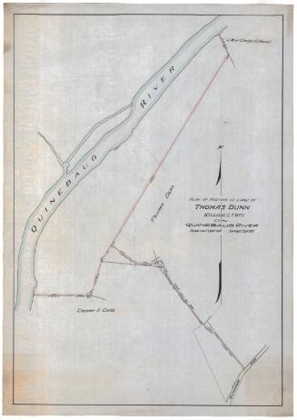
William Lester Jr.
Date1835
MediumDrawing; ink, pencil, and watercolor on wove paper
DimensionsPrimary Dimensions (image height x width): 24 1/4 x 37 5/8in. (61.6 x 95.6cm)
Sheet (height x width): 26 1/4 x 39 1/2in. (66.7 x 100.3cm)
ClassificationsGraphics
Credit LineGift of Mrs. George Nichols
Object number1985.212.1
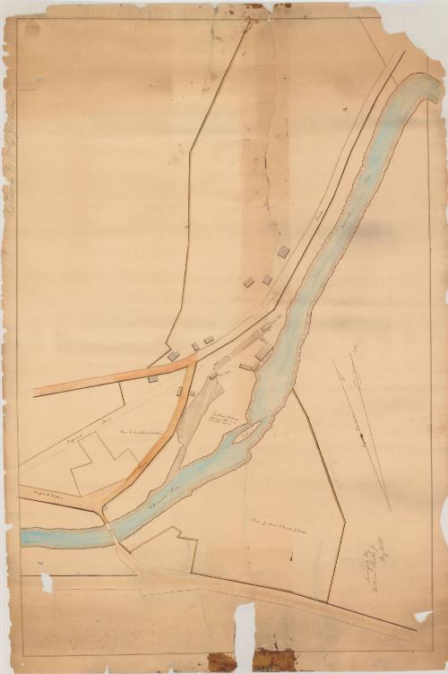
DescriptionMap of the Willimantic River and the mill village of Willimantic. The turnpike to Hartford, a bridge across the river, other existing roads and a proposed road are shown. Buildings include a saw mill, gristmill, and paper mill. A large rock in the river is labeled "Rock." The dimensions of three plots of land are given. On one of these plots the name "John Moulton" is inscribed in pencil. The names "Ulysses Young" and "W. C. Jillson" appear on two additional plots. A compass indicating true north and magnetic north is at lower left.
Label TextSurveyor William Lester Jr. evidently produced this early map of Willimantic village for a member of the Jillson family, probably William Lawrence Jillson, whose name appears on it. It shows Willimantic at almost exactly the same time as the illustration in John Warner Barber's Connecticut Historical Collections. Although Barber mentions six cotton factories and a satinet factory as being present in 1836, the only industries apparent in this 1835 map are a sawmill, a gristmill, and a papermill. The Jillsons were already major landowners in the village, but the huge textile mills that they would eventually build there still lay years in the future at the time this map was made..
NotesCartographic Note: No scaleStatus
Not on view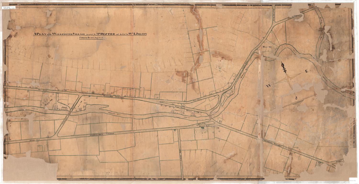


Erastus Worthington
1907