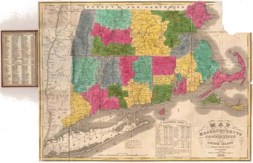
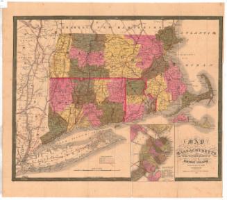
Map of Massachusetts, Connecticut and Rhode Island Constructed from the Latest Authorities
PublisherPublished by
Packard & Brown
(American, 1834 - 1837)
Date1836
MediumEngraving; black printer's ink and watercolor on wove paper, in cardboard covers
DimensionsPrimary Dimensions (image height x width): 15 x 19 1/2in. (38.1 x 49.5cm)
Sheet (height x width): 15 1/8 x 19 5/8in. (38.4 x 49.8cm)
ClassificationsGraphics
Credit LineConnecticut Museum of Culture and History collection
Object number1989.171.0
DescriptionPocket map of Massachusetts, Connecticut and Rhode Island, with parts of Vermont and New Hampshire to the north, Massachusetts and Cape Cod Bays to the east, Long Island and the Long Island Sound to the south, and part of New York State to the west. The states are outlined in pink and divided into counties, which are colored blue, gray, pink, green, or yellow. Physical features include elevation, conveyed with hachure marks, rivers, and lakes. Transportation infrastructure is reprsented on the map: principal and common roads, existing and proposed canals, and existing railroads and proposed railroads. The Farmington, Hampden, Blackstone and Middlesex Canals are existing canals, with one proposed canal between Weymouth and Taunton, Massachusetts. The Boston and Albany Railroad is shown as a proposed railroad. Below the map is a statistical table showing the populations of the counties in the states in 1820 and 1830. On the inner cover is a list of the major towns in the states and their populations.
Label TextHartford in the 1830s was the center of a flourishing printing and publishing business. During this period partnerships changed frequently and many firms lasted only a few years. In 1834, Caleb M. Packard, a bookkeeper at a Hartford bank, and Flavius A. Brown, a local teacher, formed a partnership and bought out the local publisher, H. F. Sumner & Co. Sumner & Co. had published several maps during its brief existence, and Packard & Brown apparently reissued some of these. When Caleb Packard retired in 1837, E.W. Parsons joined the firm, which, as Brown & Parsons, continued to publish some of the same maps.
NotesCartographic Note: Scale: 1 inch equals about 11 milesStatus
Not on view


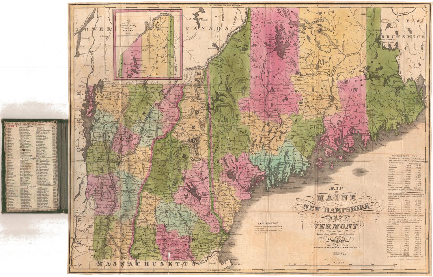
H. F. Sumner & Co.
1833