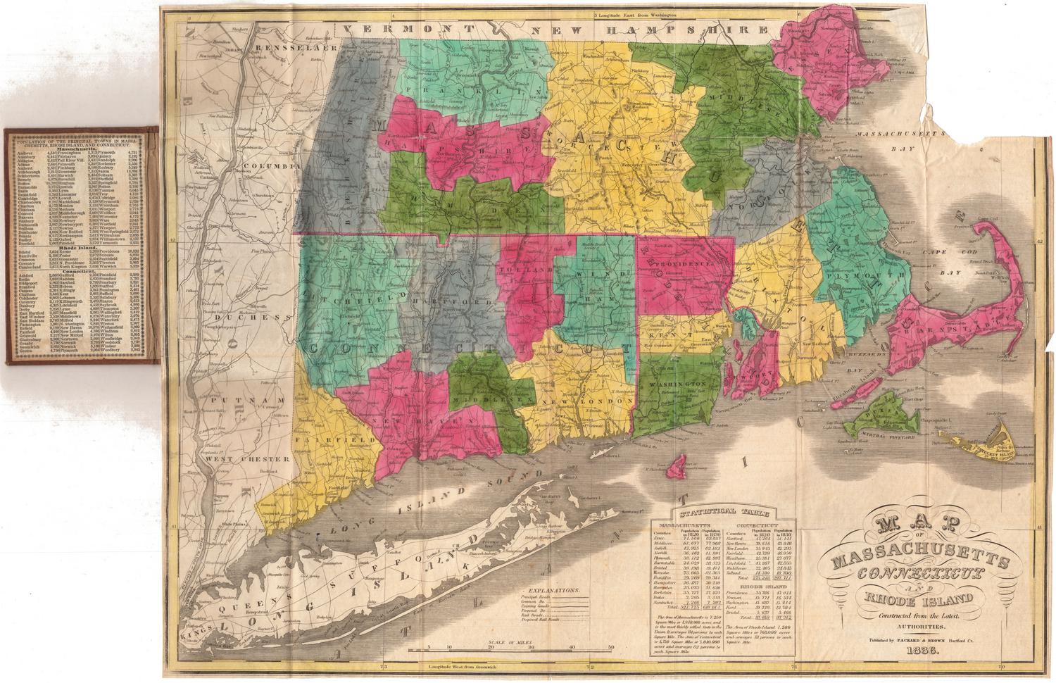
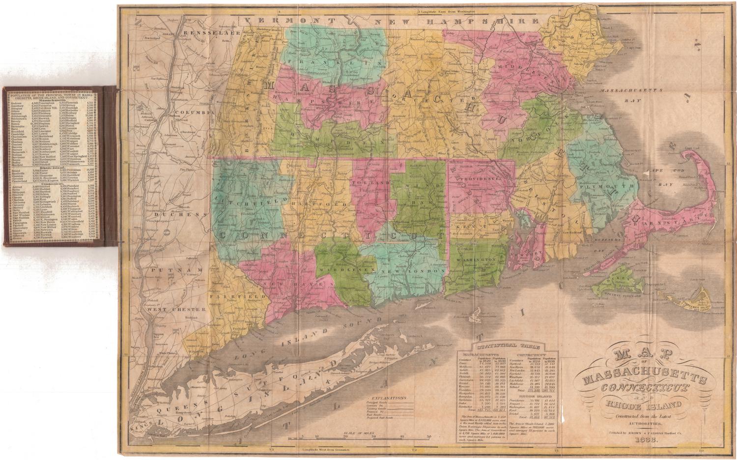
Map of Massachusetts, Connecticut and Rhode Island Constructed from the Latest Authorities
PublisherPublished by
Packard & Brown
(American, 1834 - 1837)
Date1836
MediumEngraving; black printer's ink and watercolor on wove paper, in cardboard covers
DimensionsPrimary Dimensions (image height x width): 15 x 19 1/2in. (38.1 x 49.5cm)
Sheet (height x width): 15 1/8 x 19 5/8in. (38.4 x 49.8cm)
Sheet (height x width): 15 1/8 x 19 5/8in. (38.4 x 49.8cm)
ClassificationsGraphics
Credit LineConnecticut Museum of Culture and History collection
DescriptionPocket map of Massachusetts, Connecticut and Rhode Island, with parts of Vermont and New Hampshire to the north, Massachusetts and Cape Cod Bays to the east, Long Island and the Long Island Sound to the south, and part of New York State to the west. The states are outlined in pink and divided into counties, which are colored blue, gray, pink, green, or yellow. Physical features include elevation, conveyed with hachure marks, rivers, and lakes. Transportation infrastructure is reprsented on the map: principal and common roads, existing and proposed canals, and existing railroads and proposed railroads. The Farmington, Hampden, Blackstone and Middlesex Canals are existing canals, with one proposed canal between Weymouth and Taunton, Massachusetts. The Boston and Albany Railroad is shown as a proposed railroad. Below the map is a statistical table showing the populations of the counties in the states in 1820 and 1830. On the inner cover is a list of the major towns in the states and their populations.
Object number1989.171.0
NotesCartographic Note: Scale: 1 inch equals about 11 milesOn View
Not on view


H. F. Sumner & Co.
1833