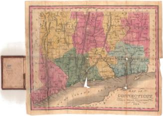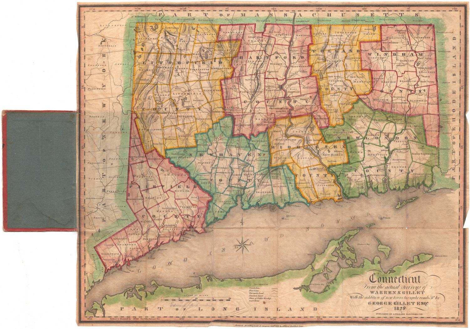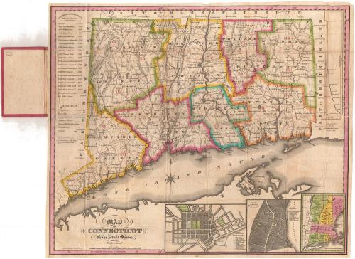
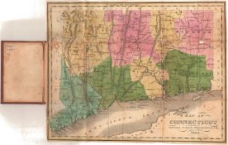
Map of Connecticut From actual Survey
PublisherPublished by
Willis Thrall
(American, 1800 - 1884)
PrintmakerEngraved by
Daggett & Ely
(American, 1831 - 1836)
Date1831
MediumEngraving; black printer's ink and watercolor on wove paper
DimensionsPrimary Dimensions (image height x width): 18 3/8 x 21 5/8in. (46.7 x 54.9cm)
Sheet (height x width): 18 3/4 x 22 1/8in. (47.6 x 56.2cm)
Sheet (height x width): 18 3/4 x 22 1/8in. (47.6 x 56.2cm)
ClassificationsGraphics
Credit LineConnecticut Museum of Culture and History collection
DescriptionPocket map of Connecticut, with part of Massachusetts to the north, part of Rhode Island to the east, part of Long Island and the Long Island Sound to the south, and part of New York to the west. The state is divided into eight counties, each outlined in either green, yellow, blue, pink or orange. Town divisions are denoted with lines, not colors. Counties and towns are both labeled. Cities are denoted with groups of black squares. The locations of houses of worship and courthouses are marked with symbols. There are numbers representing districts, although it is unclear what the districts themselves represent. Physical features include elevation, conveyed through hachure marks; rivers; and lakes. On the left side is a list of governors from 1665-1831. At the bottom of the sheet are inset maps of New Haven, Hartford, and the New England states.
Object number1989.170.0
NotesCartographic Note: Scale: 1 inch equals about 5 milesOn View
Not on view


Kellogg & Bulkeley
1910-1915
Kellogg & Bulkeley
1915-1920