Map of Massachusetts, Connecticut and Rhode Island, Constructed from the Latest Authorities
PublisherPublished by
Brown and Parsons
(American, 1838 - 1851)
Date1845
MediumEngraving; black printer's ink and watercolor on wove paper, in cardboard covers
DimensionsPrimary Dimensions (image height x width): 15 x 20in. (38.1 x 50.8cm)
Sheet (height x width): 15 1/8 x 20 1/8in. (38.4 x 51.1cm)
Sheet (height x width): 15 1/8 x 20 1/8in. (38.4 x 51.1cm)
ClassificationsGraphics
Credit LineMuseum purchase
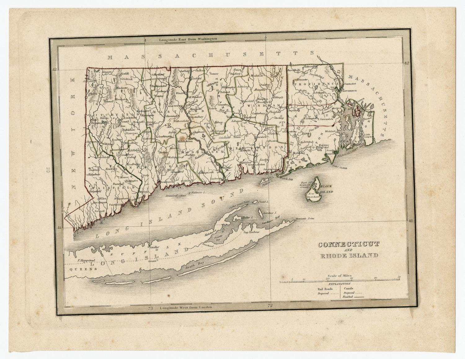
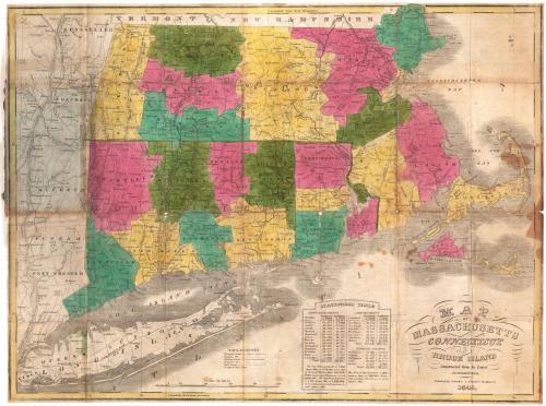
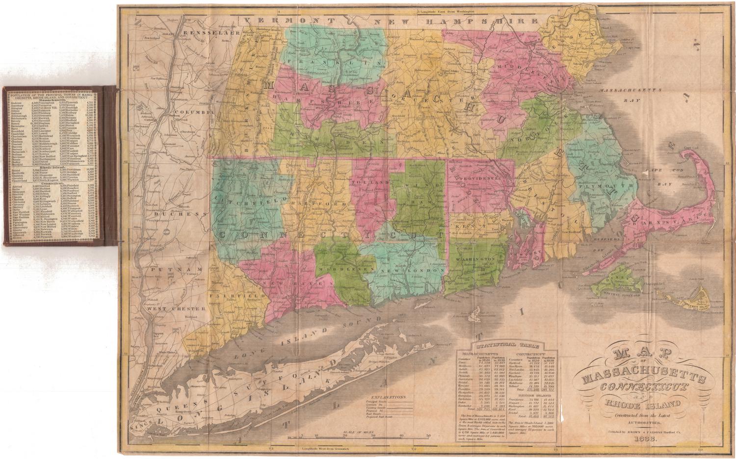
DescriptionPocket map of Massachusetts, Connecticut and Rhode Island, with parts of Vermont and New Hampshire to the north, Massachusetts and Cape Cod Bays to the east, Long Island and the Long Island Sound to the south, and part of New York State to the west. The states are divided into counties, colored green, blue, yellow or pink. The map shows transportation routes: main roads, local roads, existing and proposed canals, and existing and proposed railroads are depicted with different types of lines. The Farmington, Hampshire and Hampden, Blackstone, and Nashua Canals are on the map. Proposed railroad routes include one along the Housatonic River; between New Haven and Springfield, Massachusetts;between Norwich, Connecticut and Worcester, Massachusetts; and between Stonington, Connecticut, and Boston. The proposed line of the Western Railroad, between Hudson, New York, and Worcester, Massachusetts, is also shown. Physical features depicted include elevation, conveyed through hachure marks; rivers; and lakes. A county population table for 1820 and 1830 is below the map, and population information for the towns in each state is on the inside cover.
Object number1987.285.0
NotesCartographic Note: Scale: 1 inch equals about 9 milesOn View
Not on view


H. F. Sumner & Co.
1833