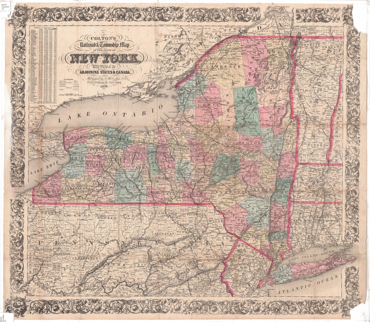
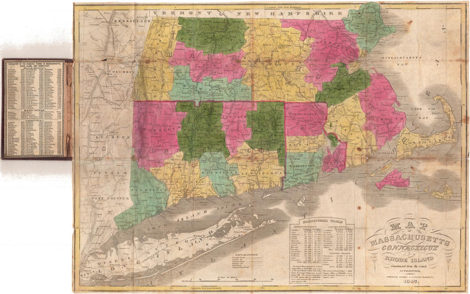
Map of the Rail-Roads of the State of New York
SurveyorSurveyed by
George R. Perkins
(American, 1812 - 1876)
SurveyorPrepared under the direction of
Van Rensselaer Richmond
(American, 1812 - 1883)
DraftsmanDrawn by
David Vaughan
PrintmakerLithographed by
Weed, Parsons & Co.
(American, founded about 1849)
Date1862
MediumLithography; black printer's ink and watercolor on wove paper
DimensionsPrimary Dimensions (image height x width): 21 7/8 x 28 3/4in. (55.6 x 73cm)
Sheet (height x width): 24 x 30in. (61 x 76.2cm)
ClassificationsGraphics
Credit LineGift of Ellen E. Flagg and Mrs. Harvey I. Maxson
Object number1930.11.2
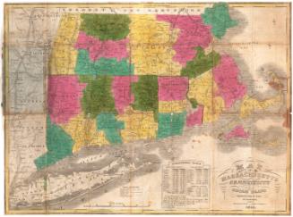
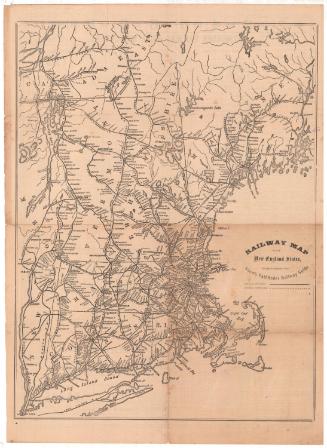
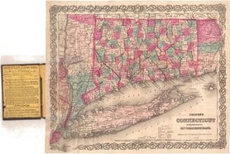
DescriptionMap of the state of New York, with Canada to the north and west; Vermont, New Hampshire, Massachusetts, and Connecticut to the east; and Pennsylvania to the south. The state is divided into counties, and elevation is conveyed with hachure marks, but the real emphasis of the map is the operating, in progress and proposed railroads of the area. The operating railroads were the Grand Trunk; Hamilton and Toronto; Great Western; Lockport and Niagara Falls; Niagara Bridge and Canadiagua; Erie; New York Central; Buffalo, New York, and Erie; Rochester and Syracuse Direct; Cayuga and Sasquehanna; Syracuse, Binghamton and New York; Watertown and Ogdenburgh; Northern; Saratoga and White Hall; Hudson River; and Long Island Railroads. Railroads in the New England states and Pennsylvania are also shown, including the New York and New Haven; New Haven, Hartford and Springfield; New Haven and Northampton; Naugatuck; Housatonic; Willimantic and Palmer; and Norwich and Worcester Railroads in Connecticut. Railroads in progress in New York were the Buffalo and Pittsburg; Lake Ontario, Auburn and New York; Albany and Susquehanna; and Lake Ontario and Hudson River. Proposed railroads were Olean and Corning; Black River and Utica; Black River; and between the Moose River and Fonda. A proposed railroad from Danbury, Connecticut, to Farmington, Connecticut, is also shown. Canals are depicted on the map as well.
Label TextBeginning at an early date, Connecticut businesses made extensive use of New York State's transportation network as means for shipping their goods to western markets. In the 1820s and 1830s they relied on the Erie Canal. By the 1840s the railroads had begun to play a significant role. This 1862 map shows a extensive network of rail lines providing access to the West.
NotesCartographic Note: About 1 inch equals 15 milesStatus
Not on view