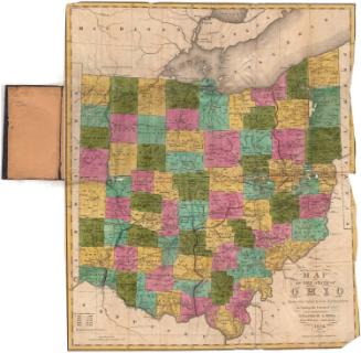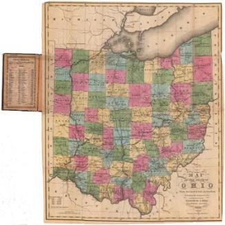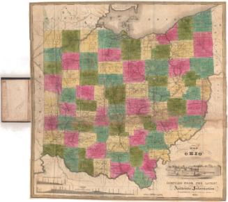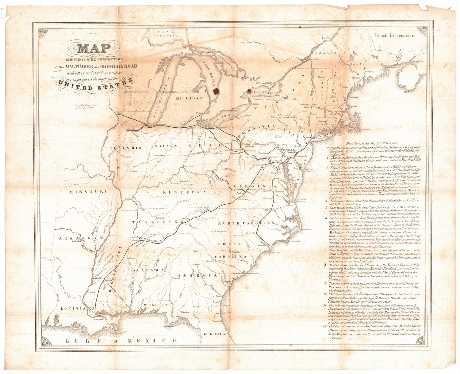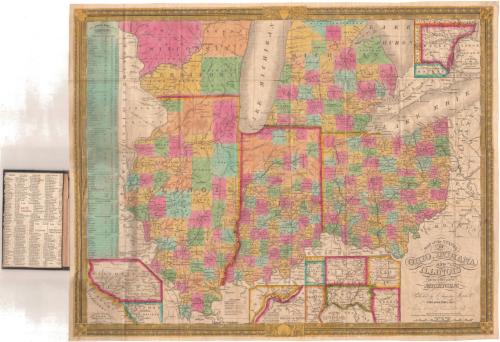
Map of the States of Ohio, Indiana and Illinois, with the settled part of Michigan.
PublisherPublished by
Samuel Augustus Mitchell
(1792 - 1868)
PublisherPublished by
Mitchell & Hinman
(American, active 1833 - 1837)
Date1835
MediumEngraving; black printer's ink and watercolor on wove paper, in cardboard covers
DimensionsPrimary Dimensions (image height x width): 17 5/8 x 22in. (44.8 x 55.9cm)
Sheet (height x width): 18 x 22 1/2in. (45.7 x 57.2cm)
Sheet (height x width): 18 x 22 1/2in. (45.7 x 57.2cm)
ClassificationsGraphics
Credit LineGift of Mrs. Francis T. Maxwell
DescriptionMap of part of Wisconsin Territory, part of Michigan, Illionois, Indiana and Ohio, with Lakes Michigan, Huron and Erie at the top. Pennsylvania and Virginia form the eastern boundary, with Kentucky to the south and Missouri and Wisconsin Territories to the west. The states and Wisconsin Territory are divided into counties, colored yellow, peach, pink, blue, or green. Roads, canals and railroads are marked with different lines and colors. The Wabash and Erie Canal, the Ohio Canal and an unnamed canal that appears to be part of the Miami and Erie Canal are shown. Two unnamed railroads in Ohio are depicted, as well. Physical features include the lakes and rivers. On the left side of the sheet is a list of steamboat routes. At the bottom are inset maps of the lead region east of the Mississippi River, the falls of Ohio, and the vicinity of Cincinnati. In the top right is an inset map of the vicinity of Detroit. The inside cover contains population information for Ohio, Indiana, Illinois and Michigan Territory.
Object number1928.10.3
NotesCartographic Note: Scale: 1 inch equals about 33 milesOn View
Not on view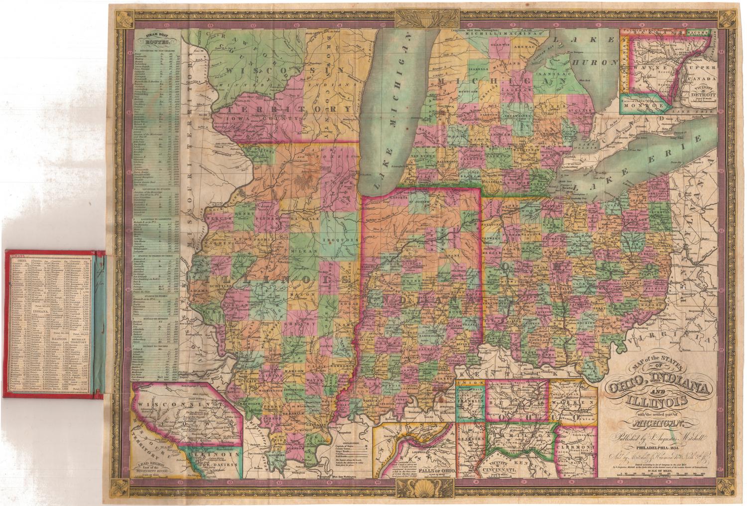
Samuel Augustus Mitchell
1834