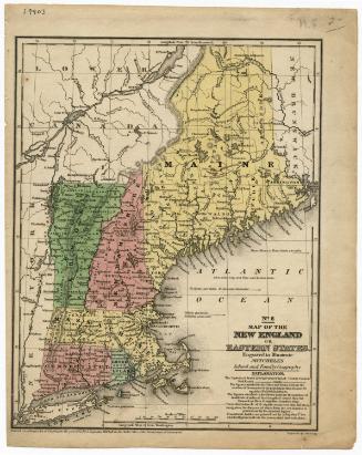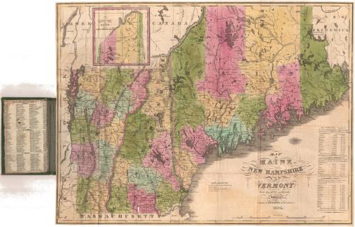
Map of Maine, New Hampshire and Vermont from the most authentic Sources
PublisherPublished by
H. F. Sumner & Co.
(American, active 1832 - 1848)
Date1834
MediumEngraving; black printer's ink and watercolor on wove paper, in cardboard covers
DimensionsPrimary Dimensions (image height x width): 14 7/8 x 19 1/2in. (37.8 x 49.5cm)
Sheet (height x width): 15 x 19 3/4in. (38.1 x 50.2cm)
Sheet (height x width): 15 x 19 3/4in. (38.1 x 50.2cm)
ClassificationsGraphics
Credit LineGift of Mrs. Francis T. Maxwell
DescriptionPocket map of Vermont, New Hampshire and southern Maine, with Lower Canada to the north, New Brunswick to the east, the border of Massachusetts to the south, and the border of New York to the west. The boundaries between the states are outlined in pink, and the states themselves are divided into counties, colored pink, blue, yellow or green. Roads are shown and the locations of towns are marked with circles and the town's name. The Explanation mentions lines used to denote canals and proposed canals, although there do not appear to be any shown on the map. Physical features depicted include elevation, conveyed with hachure marks; lakes; rivers; and islands. An inset map in the top left shows northern Maine. The inside cover lists the principal towns in each state and their populations.
Object number1928.10.1
NotesCartographic Note: Scale: 1 inch equals about 17 milesOn View
Not on view


H. F. Sumner & Co.
1833