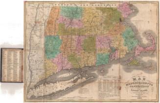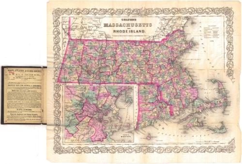
Colton's Massachusetts and Rhode Island
PublisherPublished by
G.W. & C.B. Colton & Co.
(American, founded 1865)
After a work byAfter a work by
J. H. Colton & Co.
(American, founded 1831)
Date1884
MediumLithography; black printer's ink and watercolor on wove paper, in cardboard covers
DimensionsPrimary Dimensions (image height x width): 12 1/2 x 15 3/4in. (31.8 x 40cm)
Sheet (height x width): 14 x 16 7/8in. (35.6 x 42.9cm)
ClassificationsGraphics
Credit LineGift of Charles P. Welles
Object number1928.9.1
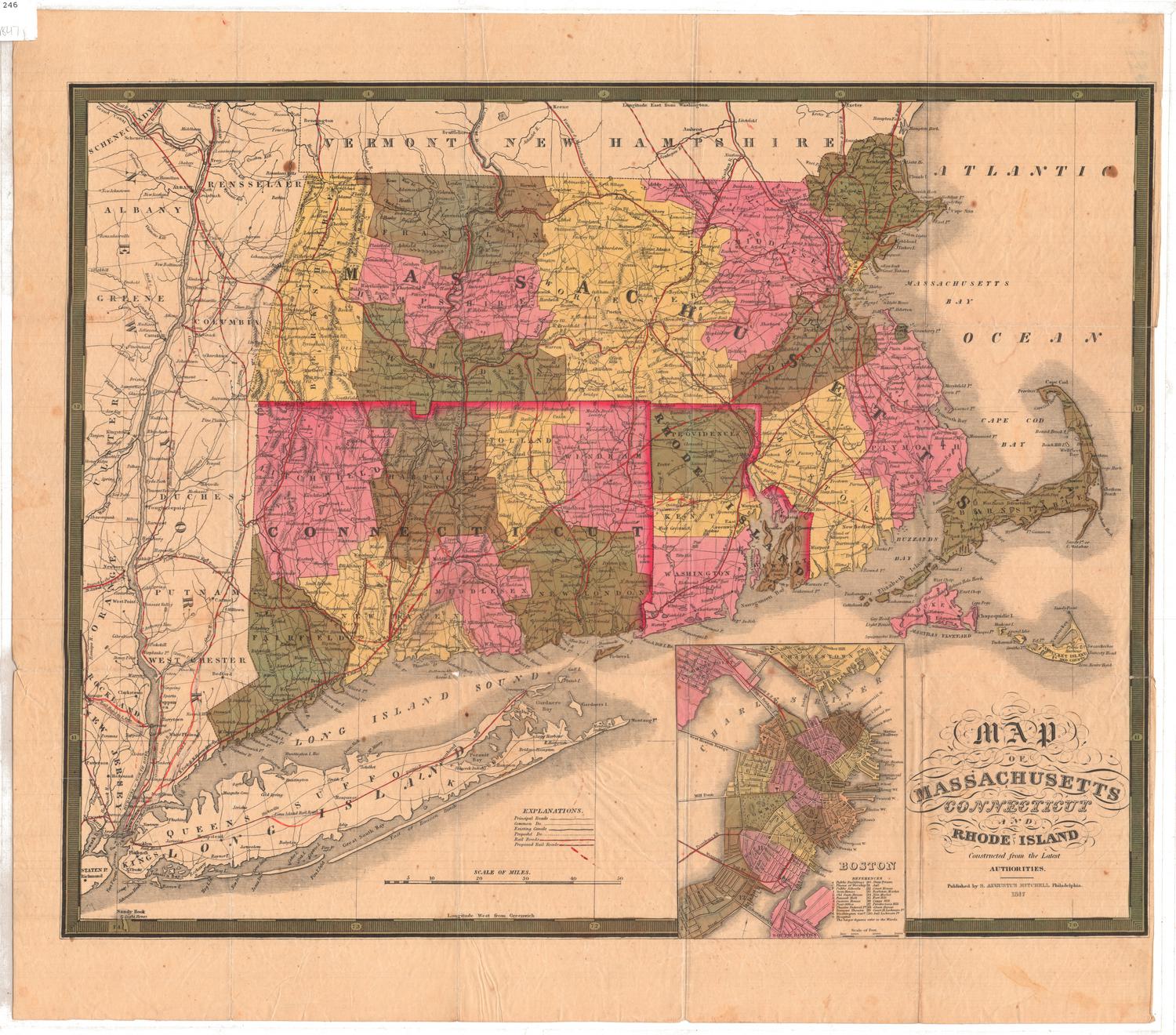
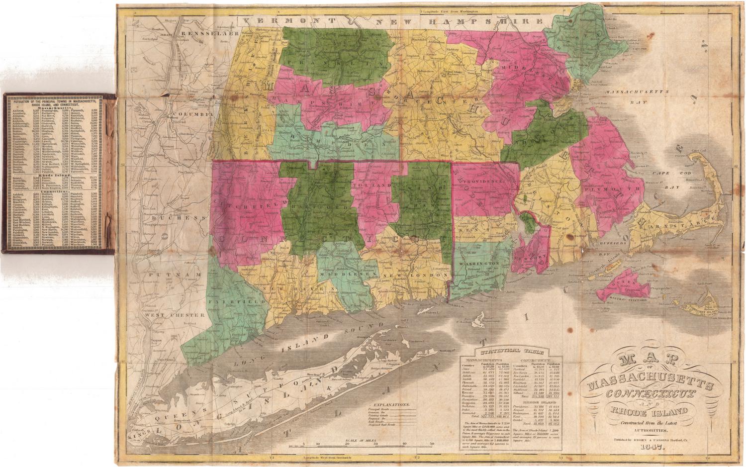
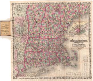
DescriptionMap of Massachusetts and Rhode Island, with Vermont and New Hampshire to the north, the Atlantic Ocean to the east, and Connecticut to the south. The states are divided into counties outlined in red; and towns, colored pink, yellow or green. There is an inset map of Boston and vicinity in the lower left corner. Railroad and canal routes and common roads are noted as being depicted with different lines in the Explanation, although no canals seem to appear on the map. Railroads include: Pittsfield and North Adams; Western; Connecticut River; New London and Willimantic; Vermont and Massachusetts; Cheshire; New York and New England; Nashua and Worcester; Worcester and Fitchburg; New York and Boston Air Line; Stonington; Bedford and Taunton; Providence; Cape Cod; Old Colony; and Boston and Lowell. The inset map of Boston shows more of area railroads, including Grand Junction, Massachusetts Central, West Cambridge and Lexington, and Saugus. Physical features on the map include elevation, conveyed through hachure marks; rivers; islands; and lakes.
Label TextA large inset map of Boston occupies the lower left hand corner of this map of Massachusetts and Rhode Island, exactly where the state of Connecticut should appear. The inside cover of this pocket map provided a good place for advertising and the publisher, G.W. & C.B. Colton & Co. used it to list the different kinds of maps that they produced: mounted maps for offices and libraries, maps for colleges and schools, pocket maps for travelers and tourists, maps for railroad and mining reports, and atlases. It is interesting to note that folding pocket maps were especially intended for use by travelers.
NotesCartographic Note: Scale: 3/8 inch equals 5 milesStatus
Not on view