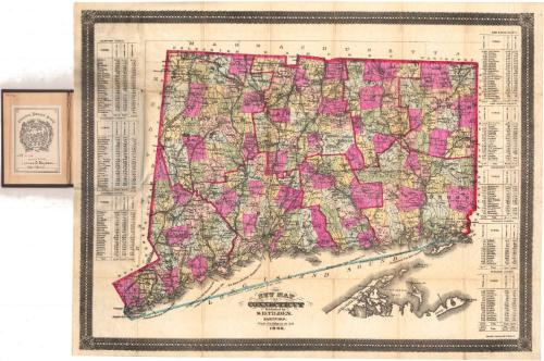
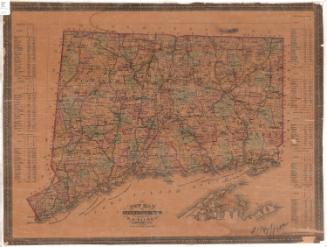
New Map of Connecticut
PublisherPublished by
Samuel D. Tilden
(American, 1828 - 1893)
PrinterPrinted by
William H. Dodd and Company
(American, 1885 - 1898)
Date1886
MediumLithography; black printer's ink and watercolor on wove paper, in cardboard covers
DimensionsPrimary Dimensions (image height x width): 20 7/8 x 27 1/4in. (53 x 69.2cm)
Sheet (height x width): 22 x 28 1/4in. (55.9 x 71.8cm)
ClassificationsGraphics
Credit LineGift of Lucius B. Barbour
Object number1923.10.2
DescriptionPocket map of the state of Connecticut, with the border of Massachusetts to the north, the border of Rhode Island to the east, part of Long Island and the Long Island Sound to the south, and the border of New York State to the west. The state is divided into counties, outlined in red; and towns, colored green, blue, yellow or pink. The New York, New Haven and Hartford; Portchester and Ridgefield (unfinished); Danbury and Norwalk; Boston, Hartford and Erie; Housatonic; Shepaug; Hartford, Providence and Fishkill; Boston and New York Air Line; Shore Line; New York and New England; Norwich and Worcester; and the New London Northern Railroads lines are depicted. Around the edges of the map are tables for each county in the state, with the towns and their populations in 1860, 1870 and 1880 listed.
Label TextThis 1886 pocket map was printed in Hartford, Connecticut by William H. Dodd and Company, one of Hartford's most important lithographic firms, and published by the prolific local map publisher, Samuel D. Tilden. Pocket maps like this one were sold to travelers and tourists. Like modern road maps, these folding maps were highly portable, and could, literally, be carried in one's pocket.
NotesCartographic Note: Scale: 1 inch equals 4 1/2 milesStatus
Not on viewKellogg & Bulkeley
1910-1915
Lucius Stebbins & Co.
1859


