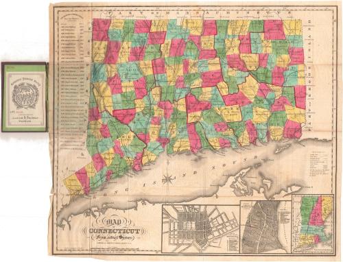
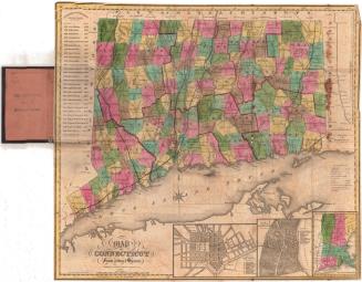
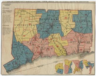
Map of Connecticut from actual Survey
PublisherPublished by
Brown & Gross
PrintmakerEngraved by
Daggett & Ely
(American, 1831 - 1836)
Date1858
MediumEngraving; black printer's ink and watercolor on laid paper, in cardboard covers
DimensionsPrimary Dimensions (image height x width): 19 1/4 x 21 1/2in. (48.9 x 54.6cm)
Sheet (height x width): 19 7/8 x 22in. (50.5 x 55.9cm)
ClassificationsGraphics
Credit LineGift of Lucius B. Barbour
Object number1923.10.1
DescriptionMap of the state of Connecticut, with part of Massachusetts to the north, part of Rhode Island to the east, Long Island and the Long Island Sound to the south, and part of New York State to the west. The state is divided into counties, outlined in red; and towns, colored red, blue, green, yellow or pink. There are numbers on the map that denote "districts," although it is unclear what the districts refer to. Turnpikes and common roads, houses of worship, courthouses, canals, and railroads are all shown. The railroad lines depicted include the New York and New Haven; New Haven and New London; Danbury and Norwalk; Housatonic; Naugatuck; New Haven and Northampton; New Haven, Hartford and Springfield; Providence, Hartford and Fishkill; New London, Willimantic and Palmer; and Norwich and Worcester Railroads. Physical features include elevation, conveyed through hachure marks; rivers; and lakes. To the left is a list of the governors of Connecticut from 1665-1858. Below the map are insets of New Haven, Hartford, and the New England states.
Label TextDaggett & Ely, the New Haven engravers who engraved this map of Connecticut, went out of business in 1836, but the plate that they engraved continued to be updated and was used well into the 1850s. By 1858, it was evidently in the hands of Brown & Gross, a Hartford bookseller, who issued this folding map in that year. Even though map publishing had become big business by 1858, with the major printers and publishers located in Philadelphia and New York, some maps continued to be produced locally for local consumption.
NotesCartographic Note: Cartographic Note: About 7/8 inch equals 5 milesStatus
Not on view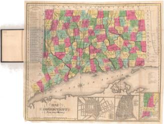
Kellogg & Bulkeley
1910-1915

Kellogg & Bulkeley
1915-1920
