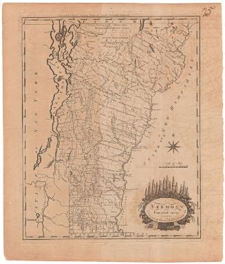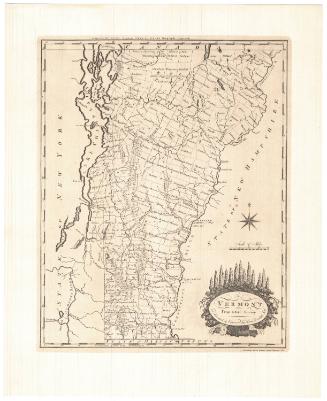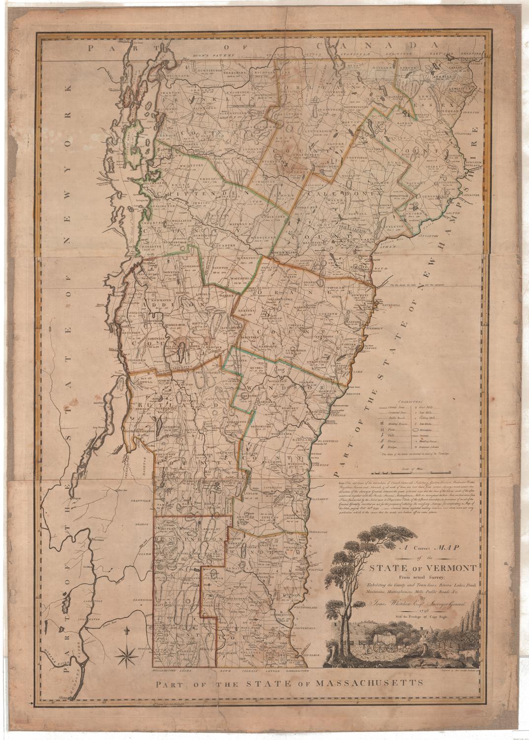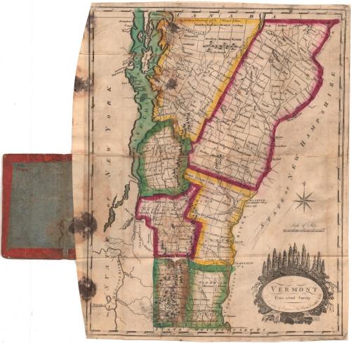
Vermont from Actual Survey
DraftsmanDrawn by
Amos Doolittle
(American, 1754 - 1832)
PrintmakerEngraved by
Amos Doolittle
(American, 1754 - 1832)
Date1795 or later
MediumEngraving; black printer's ink and watercolor on wove paper, in cardboard covers
DimensionsPrimary Dimensions (image height x width): 14 7/8 x 11 5/8in. (37.8 x 29.5cm)
Platemark (height x width): 15 1/4 x 12in. (38.7 x 30.5cm)
Sheet (height x width): 15 3/8 x 12 5/8in. (39.1 x 32.1cm)
Platemark (height x width): 15 1/4 x 12in. (38.7 x 30.5cm)
Sheet (height x width): 15 3/8 x 12 5/8in. (39.1 x 32.1cm)
ClassificationsGraphics
Credit LineMuseum purchase
DescriptionMap of Vermont, with Canada to the north, New Hampshire to the east, Massachusetts to the south, and New York to the west. Vermont is divided primarily into counties, each outlined in red, yellow or green. Town divisions and names are also shown. Dartmouth is located along the Connecticut River in Windsor County. Physical features depicted include elevation, conveyed with clusters of peaks; rivers; and lakes, including Lake Champlain. Roads are shown but not labeled. Waterfalls and tall trees adorn the cartouche.
Object number1912.7.0
NotesCartographic Note: Scale: About 1/2 inch equals 5 milesOn View
Not on view