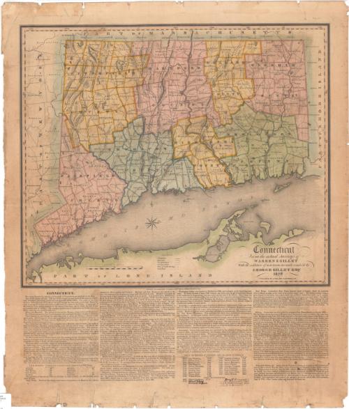
Connecticut from the actual surveys of Warren & Gillet With the addition of new towns, turnpike roads &c by George Gillet
SurveyorSurveyed by
Moses Warren Jr.
(1762 - 1835)
SurveyorSurveyed by
George Gillet
(American, 1771 - 1853)
DraftsmanDrawn by
George Gillet
(American, 1771 - 1853)
PublisherPublished by
Asaph Willard
(1786 - 1880)
Date1829
MediumEngraving; printer's ink and watercolor on wove paper
DimensionsPrimary Dimensions (image height x width): 18 x 21 1/4in. (45.7 x 54cm)
Sheet (height x width): 27 1/2 x 23 3/4in. (69.9 x 60.3cm)
ClassificationsGraphics
Credit LineConnecticut Museum of Culture and History collection
Object number2005.197.0
DescriptionMap of the state of Connecticut with the border of Massachusetts to the north, Rhode Island to the east, part of Long Island and the Long Island Sound to the south, and New York to the west. The state is divided into counties which are labeled and delineated with broken solid and dotted lines, and towns which are labeled and delineated with solid lines. Turnpike roads are denoted with solid parallel lines and common roads with dotted lines. Population centers are shown as clusters of dots, with places of public worship and courthouses denoted with symbols. Elevation is conveyed through hachure marks. Rivers, ponds and lakes, islands and harbors are shown. Below the map is text that describes the natural features, cities, academic institutions, prisons and the history of Connecticut. The list of governors has been updated in manuscript through 1844.
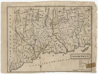
Label TextAsaph Willard, who engraved the 1820 map of Connecticut based on the survey by Moses Warren and George Gillet, was the publisher of this 1829 updated version. New towns include Madison, incorporated in 1826, and Prospect, incorporated in 1827. Also included for the first time in this version is the Farmington Canal, begun in 1825. Willard continued to reissue this important map, with revisions by surveyor general George Gillet, through the 1830s and into the 1840s. The list of governors on this copy of this 1829 map has been annotated through 1844, indicating that this copy continued to be used, even though by 1844 it would have been substantially out of date due to new towns being added and new railroads being constructed.
NotesCartographic Note: Scale: 15/16 inches equals 5 milesStatus
Not on view


