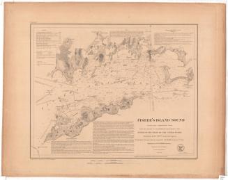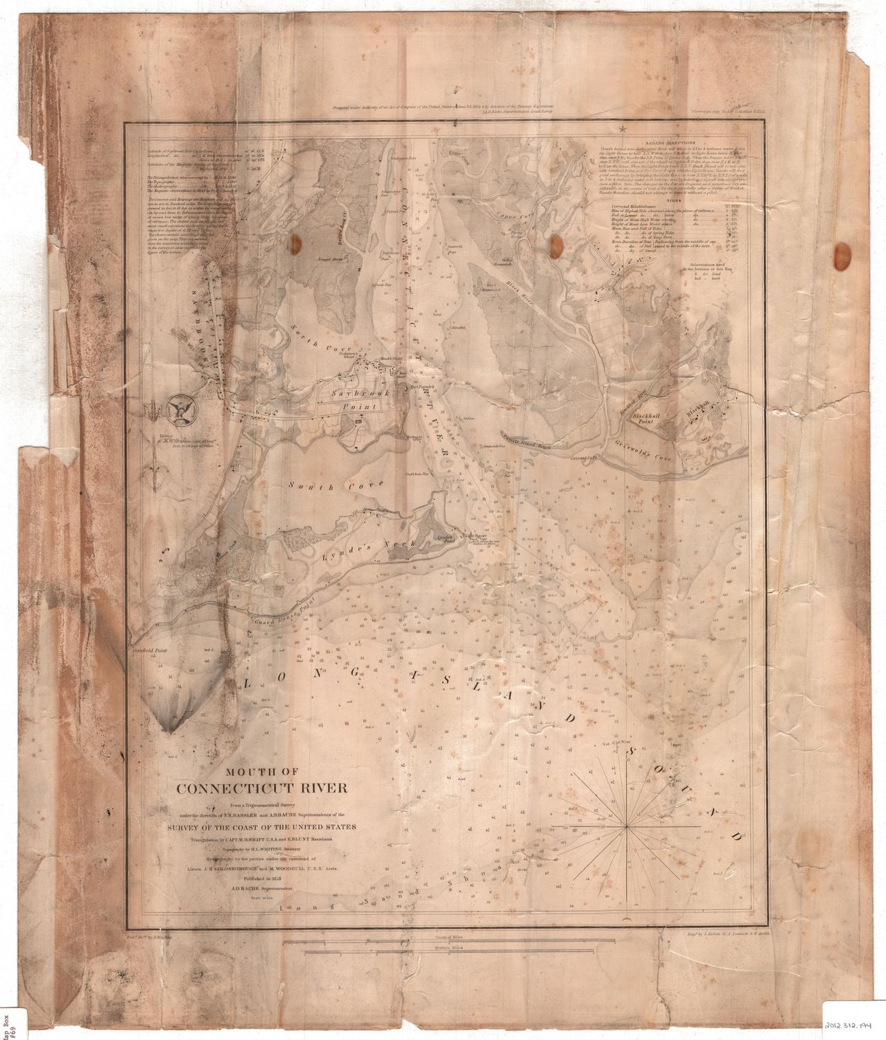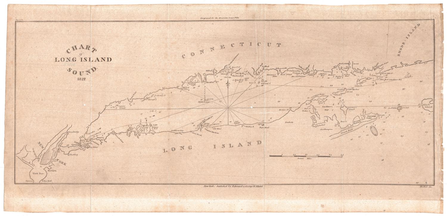
Chart of Long Island Sound
PrintmakerEngraved by
William Hooker
(American, 1782 - 1856)
PublisherPublished by
Edmund and George W. Blunt
(American, 1830 - 1866)
PublisherPublished by
American Coast Pilot
(American, 1796 - 1867)
Date1827
MediumEngraving; printer's ink on wove paper
DimensionsPrimary Dimensions (image height x width): 6 3/4 x 17 1/8in. (17.1 x 43.5cm)
Sheet (height x width): 8 1/2 x 18in. (21.6 x 45.7cm)
ClassificationsGraphics
Credit LineMuseum purchase
Object number2007.83.0
DescriptionChart of Long Island Sound from New York Harbor to the west to Block Island to the east. The Connecticut coast is to the north and the coast of Long Island is to the south. Lighthouses are indicated. A small sailing vessel is depicted on a course between Fisher's Island and Great Gull Island. Soundings are given. Notations provide additonal information such as "This reef sometimes dry" and "Good Fishing Ground." A scale of statute miles is at lower right.
Label TextEdmund March Blunt published the first edition fo The American Coast Pilot in Newburyport, Massachusetts in 1796. About 1827, his sons, Edmund and George William Blunt, assumed responsibility for the publication, now based in New York City. Early editions relied on verbal descriptions of sailing directions and navigational landmarks, but later editions included small charts such as this one of Long Island Sound. The Blunts continued to issue this essential guide for sailors until 1867, when they sold the rights to the United States Coast Survey.
NotesCartographic Note: One inch equals ten milesStatus
Not on view