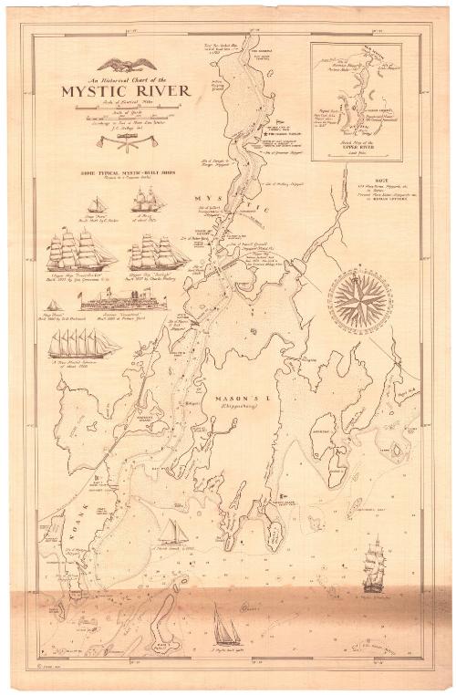
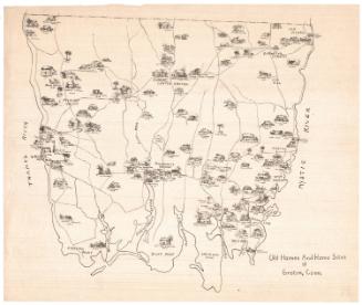
An Historical Chart of the Mystic River
DraftsmanDrawn by
John E. Dodge
(American, 1916 - 1978)
Date1949
MediumLithography; brown printer's ink on laid paper
DimensionsPrimary Dimensions (image height x width): 23 3/8 x 14 7/8in. (59.4 x 37.8cm)
Sheet (height x width): 24 5/8 x 16in. (62.5 x 40.6cm)
Sheet (height x width): 24 5/8 x 16in. (62.5 x 40.6cm)
ClassificationsGraphics
Credit LineMuseum purchase
DescriptionChart showing the Mystic River, from the Narrows to the north to Ram Island to the south. Water depth is marked in feet. Many of the physical features of the area are labeled, including coves, points, islands and necks, as are the locations of local sites, such as boat yards, yacht clubs, and the Marine Museum (now Mystic Seaport). Old place names are shown in italics and current (as of 1949) in regular text. Below the title are illustrations of seven ships that were built in Mystic: the sloop "hero," a brig, a clipper ship "David Crockett," the clipper "Twilight," the sloop "Annie," the steamer Connecticut, and a five-master schooner. Three other ships are depicted in the chart image area: a Noank smack, a Mystic-built yacht and a Mystic whaleship. In the top right is an inset map of the upper River, from Old Mystic to the north to Mystic in the south.
Object number1949.19.1
NotesCartographic Note: Scale: 3/4 inch equals 1/8 mile
Constituent Note: J. E. Dodge also produced an historical chart of Stonington Harbor, 1649-1949.On View
Not on view
Artvue Post Card Co.
1900-1950
Lieutenant William Augustus Wetmore
1887-1895