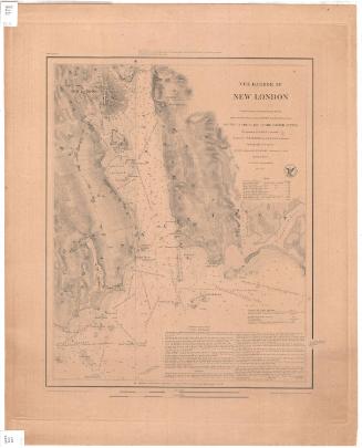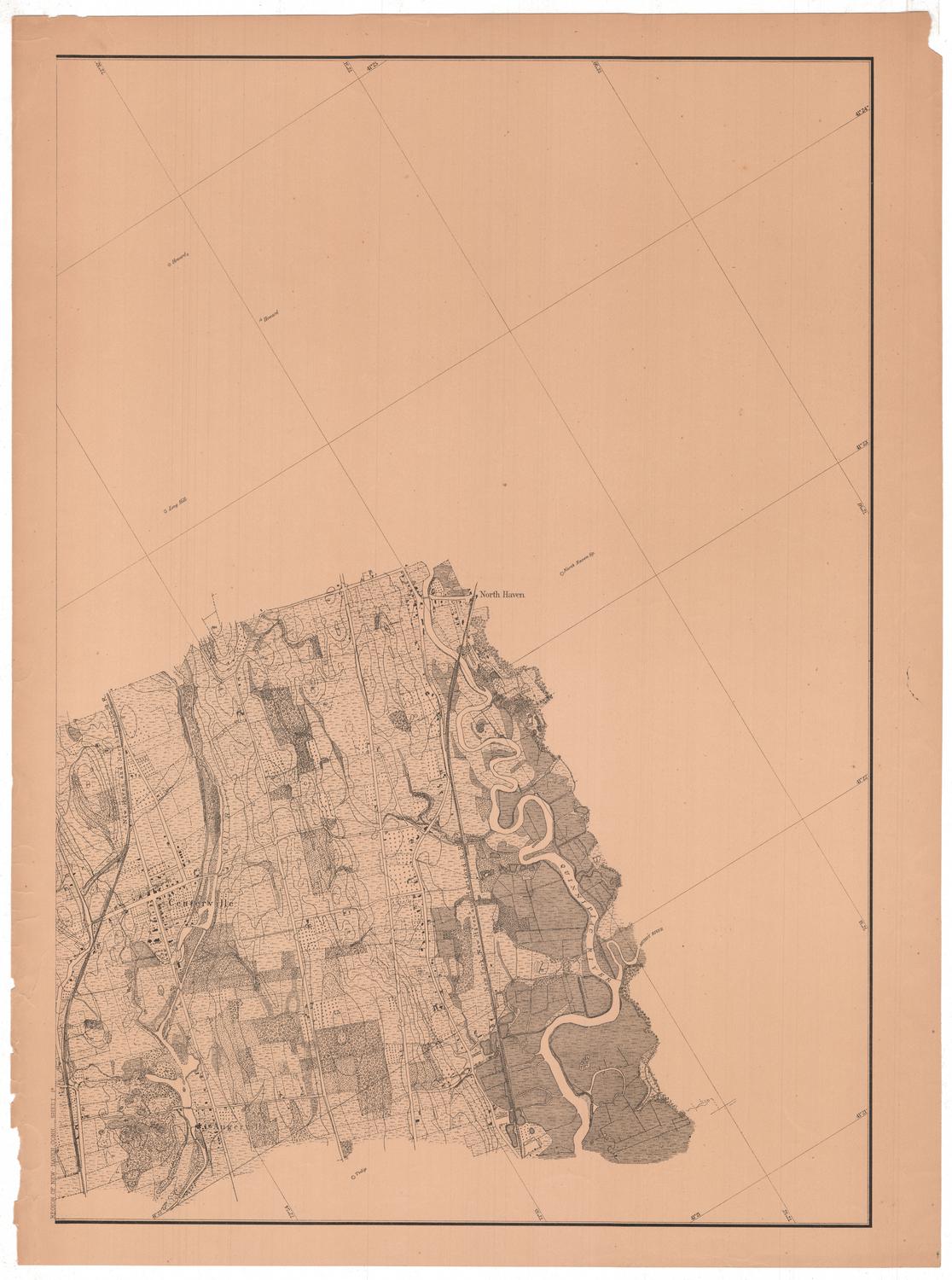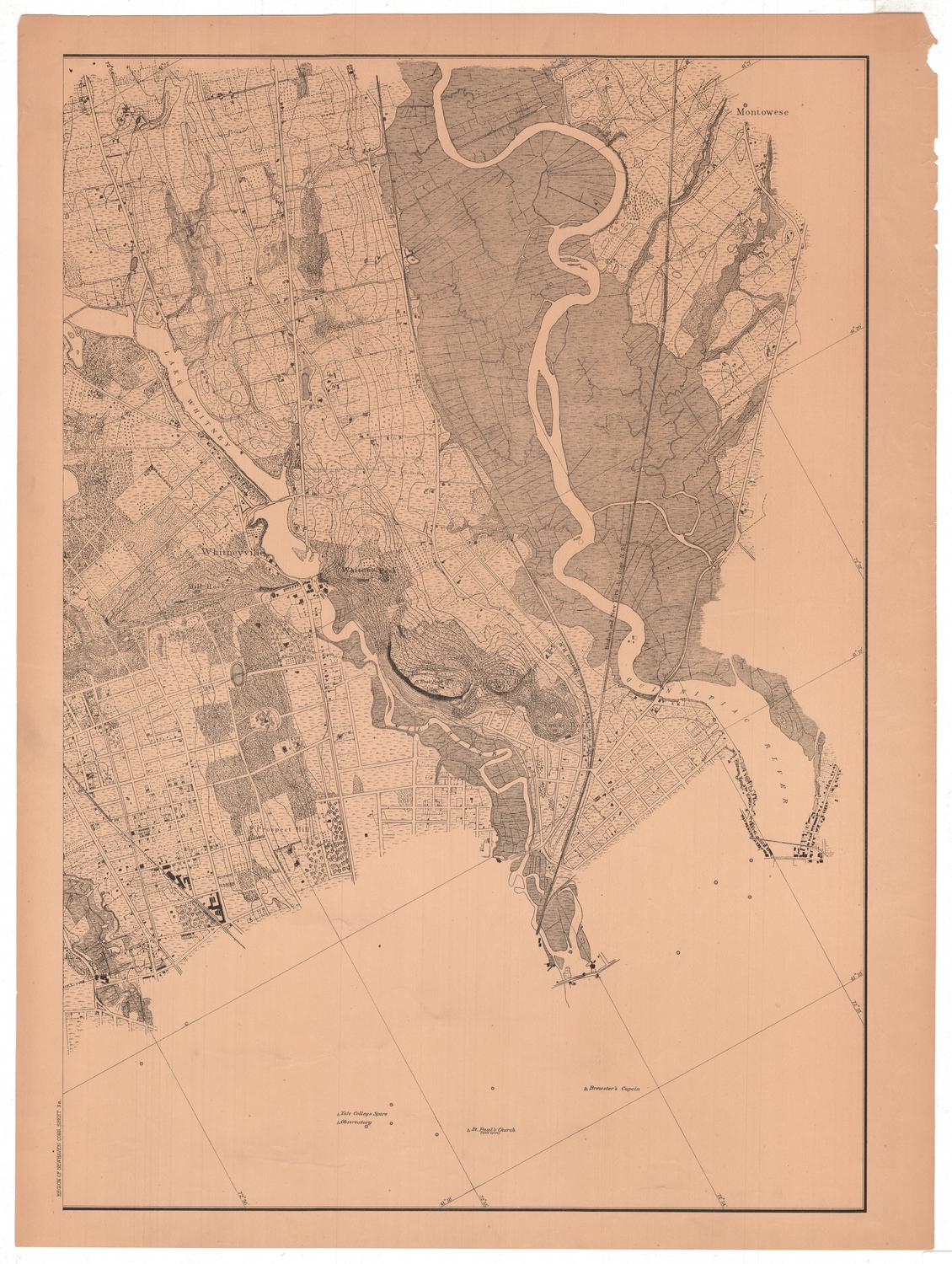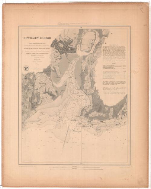
New Haven Harbor
PublisherPublished by
United States Coast Survey
(American, founded 1807)
SurveyorUnder the direction of
Ferdinand Rudolph Hassler
(American, 1770 - 1843)
PublisherUnder the direction of
Alexander Dallas Bache
(American, 1806 - 1867)
SurveyorTriangulation by
James Ferguson
(American, 1797 - 1867)
SurveyorTriangulation by
Edmund Blunt
(American, 1799 - 1866)
SurveyorHydrography by
George S. Blake
(American, 1802 - 1871)
SurveyorTopography by
Constant M. Eakin
(French-American, 1794 - 1870)
MakerTopography by
William M. Boyce
(American, 1801 - 1855)
SurveyorTopography by
John Farley
(American, died 1874)
SurveyorVerified by
Andrew Atkinson Humphreys
(American)
DraftsmanDrawn by
John B. Gluck
(American, died 1852)
PrintmakerEngraved by
Sherman and Smith
(American, 1840 - 1853)
Date1846
MediumEngraving; printer's ink on wove paper on fabric
DimensionsPrimary Dimensions (image height x width): 17 1/4 x 14in. (43.8 x 35.6cm)
Sheet (height x width): 22 3/4 x 18 1/4in. (57.8 x 46.4cm)
ClassificationsGraphics
Credit LineMuseum purchase
Object number1961.105.1
DescriptionChart of New Haven Harbor from Oyster River Point to the Farm River, including Savin's Rock, West Haven, Sandy Point, Oyster Point, the Mill River, the Quinnipiac or Dragon River, Fair Haven, Fort Hale, Morris Cove, the New Haven lighthouse on Five Mile Point, and Morgan's Point. Long Wharf and the Steamboat Wharf are shown with the street plan of New Haven. Other roads and some structures are shown and the terrain is indicated. Elevation is indicated by hachure marks. Soundings are expressed in feet to eighteen feet, beyond that in fathoms. Detailed sailing directions are at upper right.
Label TextThe outer harbor of New Haven, Connecticut is four miles wide, and the city is located about four miles from its entrance. While this sounds impressive, the shallow water of the harbor posed an ongoing problem; New Haven was a major port during the 1800s and traffic in and out of the harbor was heavy. This 1846 chart clearly shows the narrow and shallow chanel leading from Long Island Sound to Long Wharf and the Steamboat Wharf where at its deepest, the water was less than ten feet deep. Dredging operations during the nineteenth century would assure that New Haven's wharves remained accessible to large ships. By 1872, the water at wharves was fifteen or more feet deep, but navigating the channel in and out of the harbor must have remained a challenge. Coast Survey maps not only served as aids to navigation, but helped inform the Corps of Engineers of areas in need of improvement..
NotesCartographic Note: 1/20,000Status
Not on view