Map of the Western Reserve including the Fire Lands in Ohio
PrintmakerEngraved by
William Savory
PublisherPublished by
Allen Taylor
Date1833
MediumEngraving; black printer's ink on laid paper, lined with paper
DimensionsPrimary Dimensions (image height x width): 12 1/8 x 20 1/2in. (30.8 x 52.1cm)
Sheet (height x width): 16 x 20 3/4in. (40.6 x 52.7cm)
Mount (height x width): 16 x 20 3/4in. (40.6 x 52.7cm)
ClassificationsGraphics
Credit LineConnecticut Museum of Culture and History collection
Object number1996.184.0
DescriptionMap of the Western Reserve and Firelands in Ohio, with Lake Erie to the north. Huron, Lorain, Medina, Cuyahoga, Geauga, Portage, Ashtabula, and Trumbull counties are depicted. The counties are divided into townships, most of which are labeled. Range numbers are also shown. Physical features include rivers, waterfalls, and the lake. Courthouses, meeting houses, colleges, mills, lighthouses, and village are marked with symbols explained in the References list. Below the map is a textual description of the Western Reserve and information about the population of Ohio and the Western Reserve counties.
Label TextIn 1792, the Connecticut legislature set aside 500,000 acres in the Western Reserve for those families from Danbury, Fairfield, Greenwich, Groton, New Haven, New London, Norwalk, and Ridgefield whose homes were burned by the British during the American Revolution. The first edition of this map was published In 1826; this second edtion was issued seven years later, in 1833. The fact that this map was produced in the 1820s and reprinted in the 1830s, long after the Western Reserve had become part of the State of Ohio, suggests that residents retained a strong sense of connection with their Connecticut roots.
NotesCartographic Note: Scale: about 7/8 inch equals 5 milesStatus
Not on view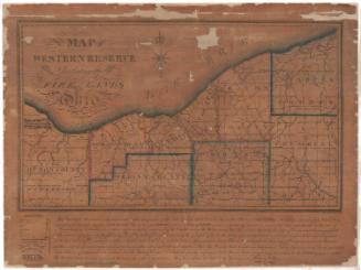


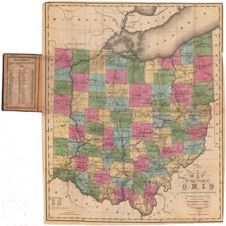
Samuel Augustus Mitchell
1834

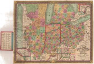
Samuel Augustus Mitchell
1835