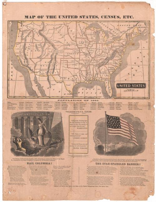
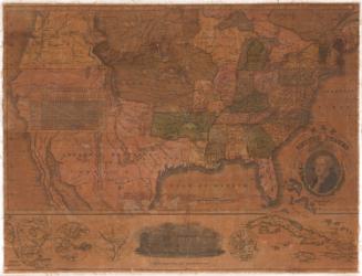
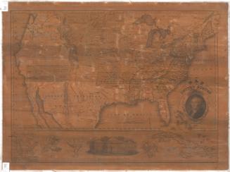
Map of the United States, Census, Etc.
PublisherPublished by
John Warner Barber
(American, 1798 - 1885)
RetailerSold by
John Warner Barber
(American, 1798 - 1885)
Date1861
MediumLithography; black printer's ink and watercolor on wove paper
DimensionsPrimary Dimensions (image height x width): 9 3/8 x 17 3/8in. (23.8 x 44.1cm)
Sheet (height x width): 24 x 18 1/2in. (61 x 47cm)
Sheet (height x width): 24 x 18 1/2in. (61 x 47cm)
ClassificationsGraphics
Credit LineGift of Laura D. Cone
DescriptionMap of the United States, with major cities marked with circles. Physical features include elevation, conveyed through hachure marks; rivers; and lakes. Directly below the map is a list of the states' populations in 1860. Below this are two vignettes, one depicting a robed figure with an eagle behind it, holding a spear and a shield, striking down a smaller figure, in front of a pillared building representing the United States. The pillars each have the names of states on them. Below this image is the caption, "The Demon of Discord and Treason, while attempting to remove the Pillars of the Republic, cemented by the blood of Martyrs, is repelled by the Genius of America." Below it are the lyrics to the patriotic song "Hail Columbia." The other vignette shows the American flag, below which are the lyrcis to "The Star-Spangled Banner." Between the two vignettes there are three quotes about the Union, one from George Washington, one from Andrew Jackson and the third from Daniel Webster.
Object number1933.36.1
NotesCartographic Note: 1/4 inch equals about 47 milesOn View
Not on view

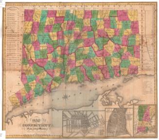
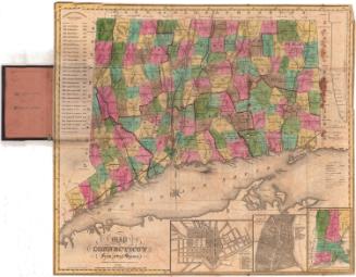

Lucius Stebbins & Co.
1859