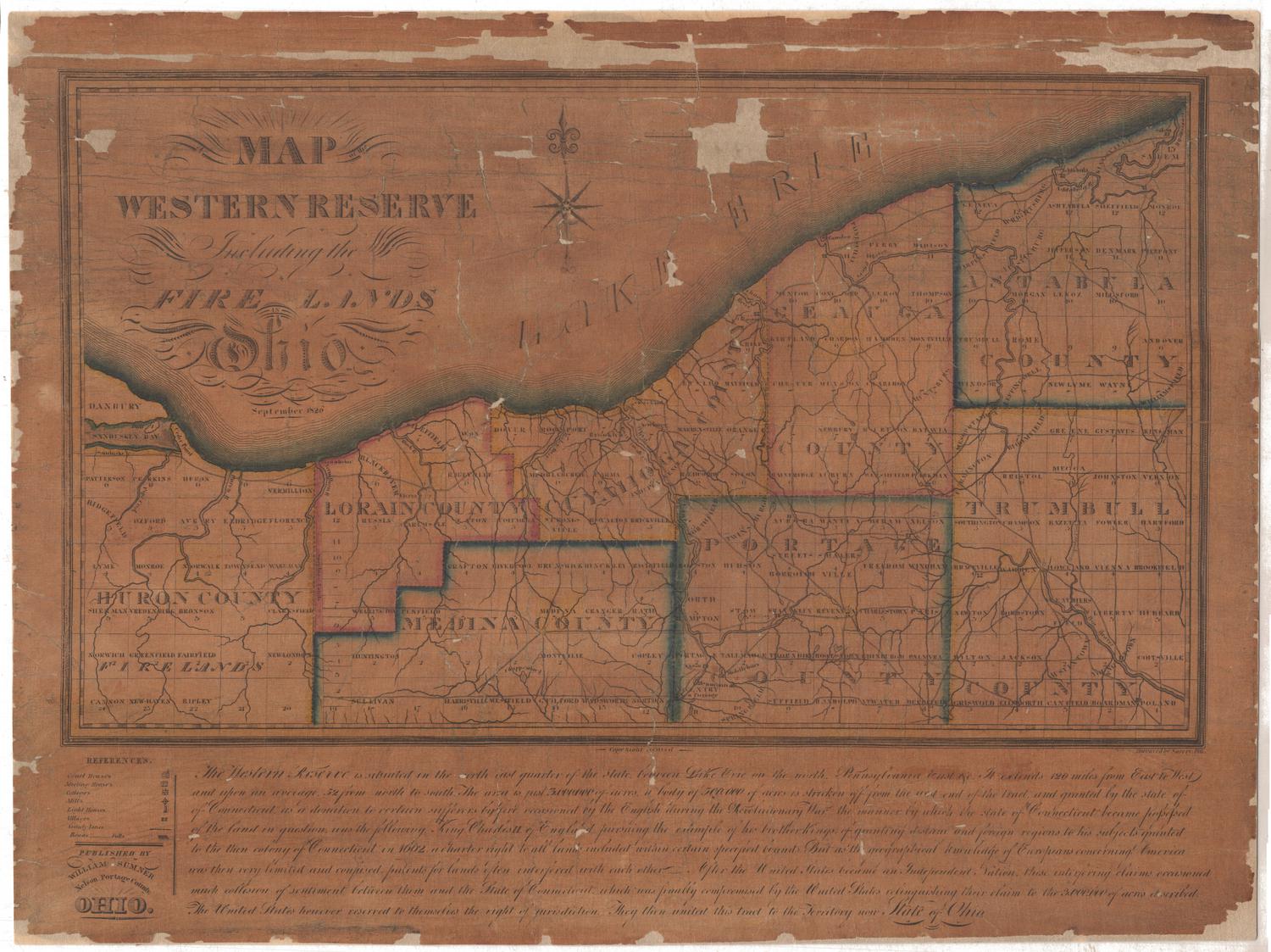
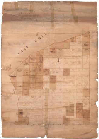
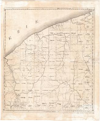
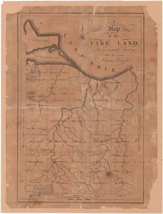
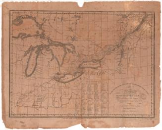
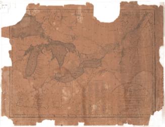
Map of the Western Reserve including the Fire Lands, Ohio
PrintmakerEngraved by
William Savory
PublisherPublished by
William Sumner
Date1826
MediumEngraving; black printer's ink and watercolor on paper, mounted on paper and lined with linen
DimensionsPrimary Dimensions (image height x width): 12 1/2 x 20 1/2in. (31.8 x 52.1cm)
Sheet (height x width): 16 7/8 x 22 3/8in. (42.9 x 56.8cm)
Mount (height x width): 16 7/8 x 22 3/8in. (42.9 x 56.8cm)
Sheet (height x width): 16 7/8 x 22 3/8in. (42.9 x 56.8cm)
Mount (height x width): 16 7/8 x 22 3/8in. (42.9 x 56.8cm)
ClassificationsGraphics
Credit LineMuseum purchase
DescriptionMap of the Western Reserve and Firelands in Ohio, with Lake Erie to the north. The map depictes Huron, Lorain, Medina, Cuyahoga, Geauga, Portage, Ashtabula (spelled "Astabula" on the map), and Trumbull counties. Each county is divided into numbered squares, some of which are labeled with the name of the townships they represented. Courthouses, meeting houses, colleges, mills, lighthouses, and villages are marked with symbols listed in the References list, in the lower left corner. Physical features depicted include the lake, rivers, and waterfalls. Roads are shown as double-parallel lines. Below the map is a textual description of the Western Reserve.
Object number1990.181.1
NotesCartographic Note: No scaleOn View
Not on view
Samuel Augustus Mitchell
1835
Samuel Augustus Mitchell
1834