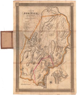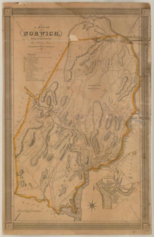
A Map of Norwich, from actual Survey
SurveyorSurveyed by
William Lester Jr.
PrintmakerEngraved by
S. Stiles & Co.
(American, 1833 - 1835)
PrinterPrinted by
S. Stiles & Co.
(American, 1833 - 1835)
PublisherPublished by
Thomas Robinson
(American, born about 1797)
Date1833
MediumEngraving; black printer's ink on wove paper, on cardboard
DimensionsPrimary Dimensions (image height x width): 29 x 19in. (73.7 x 48.3cm)
Sheet (height x width): 30 x 19 1/4in. (76.2 x 48.9cm)
Mount (height x width): 30 x 19 1/4in. (76.2 x 48.9cm)
Sheet (height x width): 30 x 19 1/4in. (76.2 x 48.9cm)
Mount (height x width): 30 x 19 1/4in. (76.2 x 48.9cm)
ClassificationsGraphics
Credit LineMuseum purchase
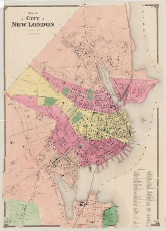
DescriptionMap of Norwich, Connecticut, from Lisbon to the north, the Shetucket River to the east, the Thames River to the south, and Bozrah and Franklin to the west. The map depicts elevation, conveyed with hachure marks; local roads; and dwellings, businesses and public buildings. It appears that dwellings are represented by shaded rectanges. In the top left corner is a list of references that correspond with lettered and numbered buildings on the map. In the lower right corner is an inset map of part of Norwich, which also contains a list of references to lettered and numbered buildings.
Object number1970.57.0
NotesCartographic Note: Scale: 1 inch equals 100 rodsOn View
Not on view