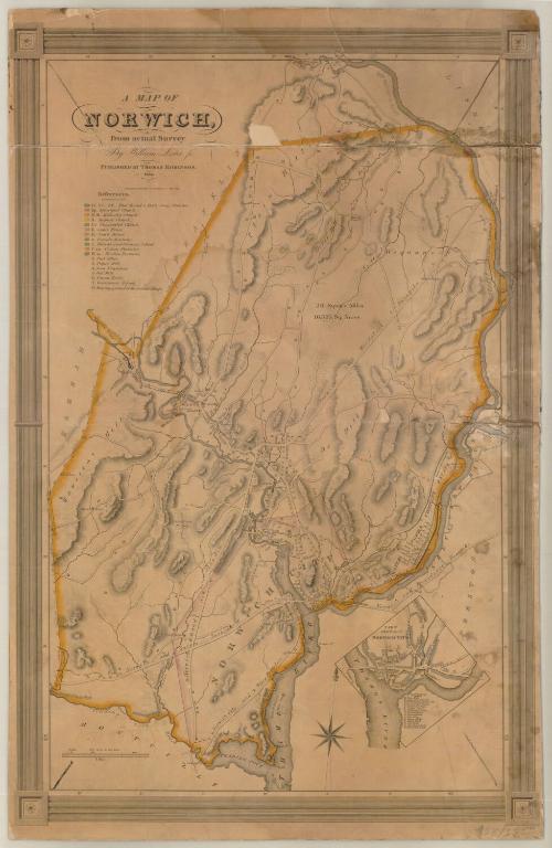
A Map of Norwich, from actual Survey
SurveyorSurveyed by
William Lester Jr.
PrintmakerEngraved by
S. Stiles & Co.
(American, 1833 - 1835)
PrinterPrinted by
S. Stiles & Co.
(American, 1833 - 1835)
PublisherPublished by
Thomas Robinson
(American, born about 1797)
Date1833
MediumEngraving; black printer's ink on wove paper, on cardboard
DimensionsPrimary Dimensions (image height x width): 29 x 19in. (73.7 x 48.3cm)
Sheet (height x width): 30 x 19 1/4in. (76.2 x 48.9cm)
Mount (height x width): 30 x 19 1/4in. (76.2 x 48.9cm)
ClassificationsGraphics
Credit LineMuseum purchase
Object number1970.57.0
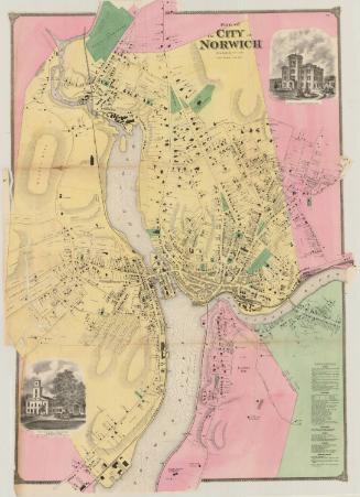
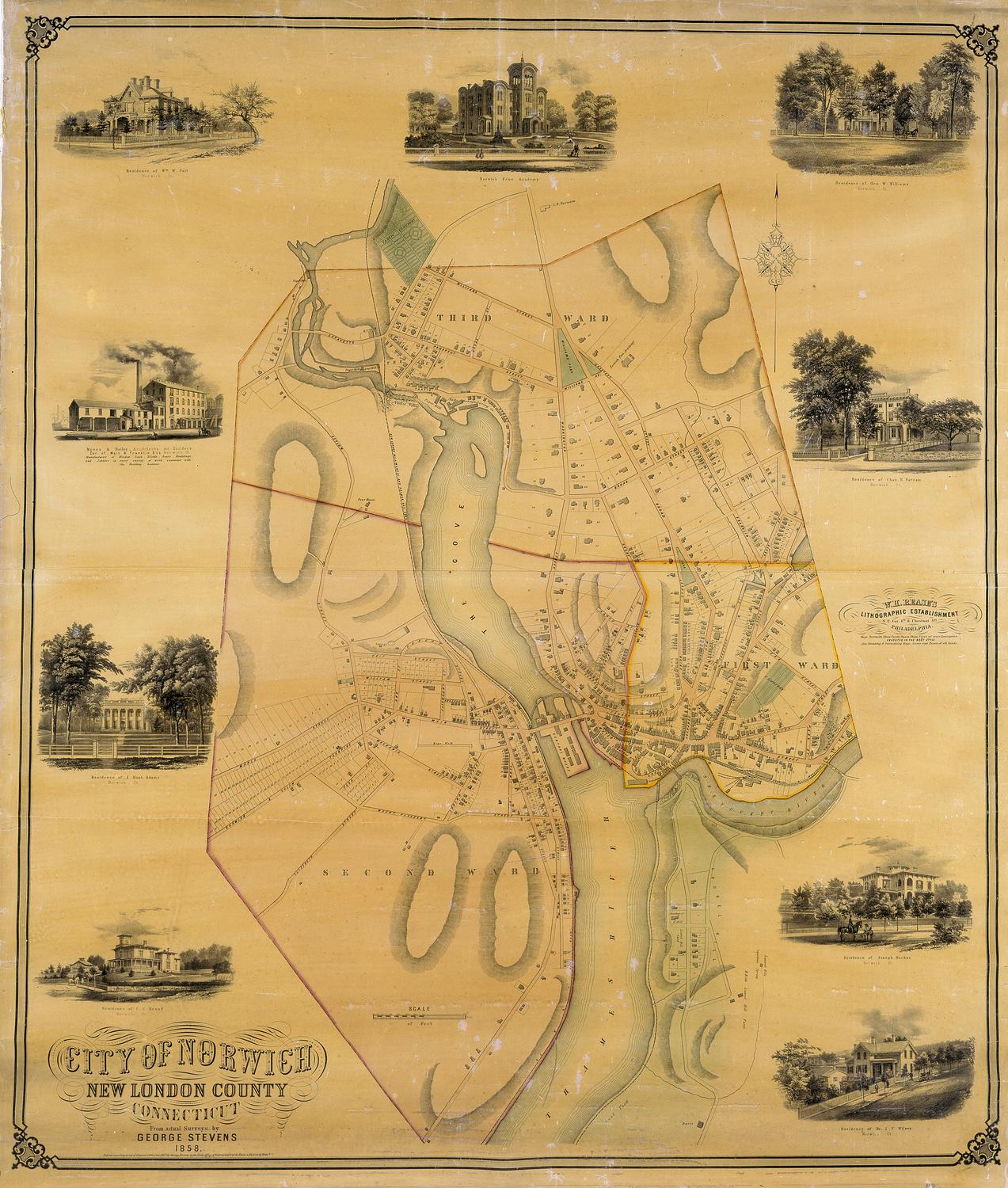
DescriptionMap of Norwich, Connecticut, from Lisbon to the north, the Shetucket River to the east, the Thames River to the south, and Bozrah and Franklin to the west. The map depicts elevation, conveyed with hachure marks; local roads; and dwellings, businesses and public buildings. It appears that dwellings are represented by shaded rectanges. In the top left corner is a list of references that correspond with lettered and numbered buildings on the map. In the lower right corner is an inset map of part of Norwich, which also contains a list of references to lettered and numbered buildings.
Label TextNorwich in 1833 was on the brink of great prosperity. Although the only industries shown on this map are a ropewalk, a pottery, a tannery, a gristmill, a paper mill, an iron foundry, and a woollen factory near Yantic Falls, within a few years, huge textile mills would be constructed along both the Yantic and Shetucket Rivers. In 1836, John Warner Barber would state that "four or five large factories, and perhaps 40 or 50 dwelling houses are, or are about to be, built." The opening of the Norwich & Worcester Railroad in 1840 would assure the city's future as a transportation hub. Goods and people arriving by steamer in Norwich would be transferred to rail cars for the remainder of their journey to Boston. By mid-century, Norwich would be one of the largest cities in Connecticut.
NotesCartographic Note: Scale: 1 inch equals 100 rodsStatus
Not on view