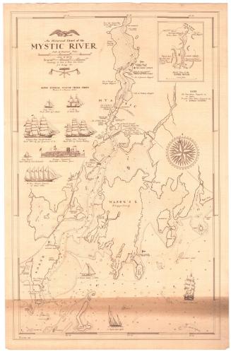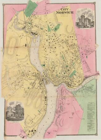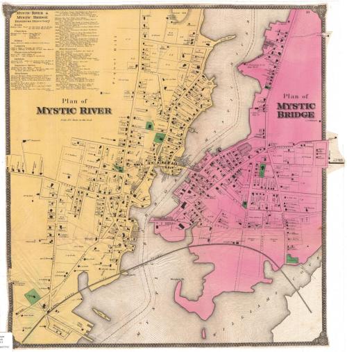
Plan of Mystic River
PublisherPublished by
Frederick W. Beers
(American, 1839 - 1933)
Date1868
MediumLithography; printer's ink and watercolor on wove paper
DimensionsPrimary Dimensions (image height x width): 21 1/2 x 20 1/2in. (54.6 x 52.1cm)
Sheet (height x width): 21 5/8 x 20 5/8in. (54.9 x 52.4cm)
ClassificationsGraphics
Credit LineMuseum purchaseMuseum purchase
Object number1980.102.3
DescriptionMap of Mystic River and Mystic Bridge, Connecticut with the Mystic River between the two communities and Williams Cove at its mouth. The Shore Line Railroad and Main Street cross the river on bridges. Names of property owners are shown. A business directory lists banks, churches, a dentist, an editor, insurance agents, lawyers, merchants, physicians, and miscellaneous.
Label TextThe twin communities of Mystic River and Mystic Bridge are situated on either side of the Mystic River. Today Mystic River is referred to simply as Mystic, and Mystic Bridge is known as West Mystic. While Mystic River was--and is located in the town of Stonington, Mystic Bridge is located in the neighboring town of Groton. This map appeared in an Atlas of New London County published in New York City in 1868.
NotesCartographic Note: 20 rods = 1 in.Status
Not on view