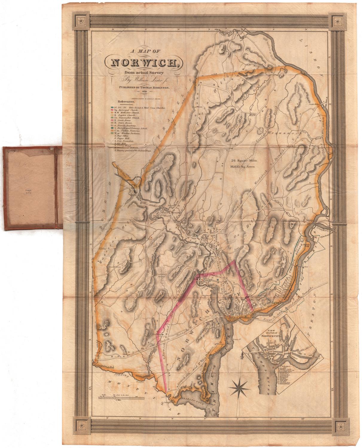
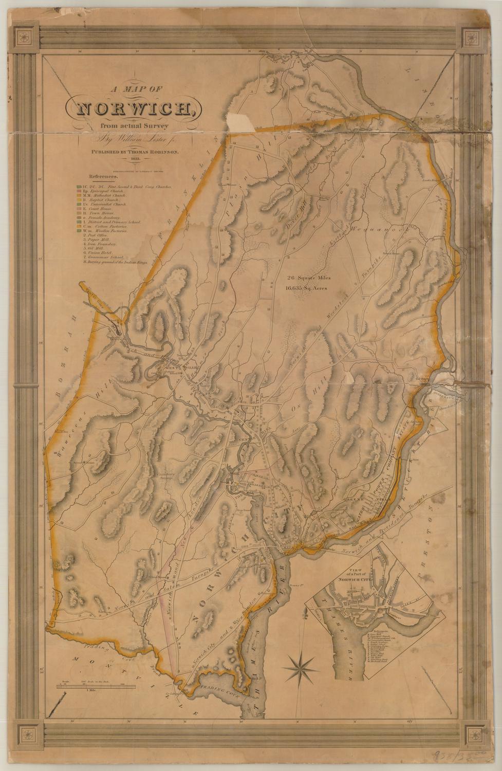
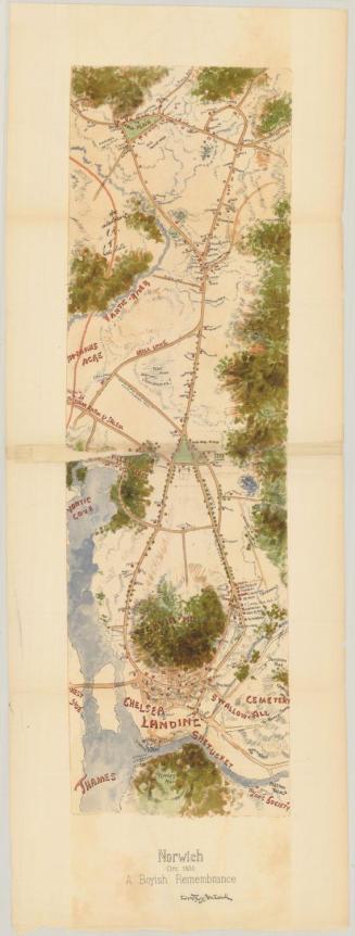
Plan of the City of Norwich
PublisherPublished by
Beers, Ellis & Soule
(American, active 1865 - 1868)
Date1868
MediumLithography; black printer's ink and watercolor on wove paper
DimensionsPrimary Dimensions (image height x width): 41 x 29 3/8in. (104.1 x 74.6cm)
Sheet (height x width): 41 1/8 x 29 1/2in. (104.5 x 74.9cm)
ClassificationsGraphics
Credit LineMuseum purchase
Object number1980.102.2
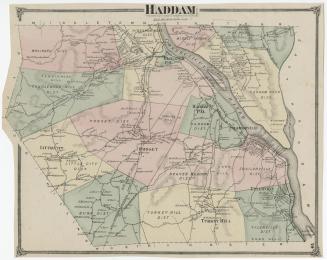
DescriptionMap of Norwich, Connecticut, situated on the Yantic, Thames and Shetucket Rivers, depicting roads, residences and businesses. The roads are labeled and the buildings are shown as black squares labeled with the owner's name. In the bottom right corner is a references list ofbanks, churches, libraries, halls, hotels and miscellaneous. In the top right corner is a vignette of the Norwich Free Academy, and in the bottom left is a vignette of the First Congregational Church. Physical features include elevation, conveyed with hachure marks, and rivers.
Label TextBy 1868, Norwich was booming. Passengers and goods arriving by steamship were transferred to the Norwich and Worcester Railroad for transport to Boston. Industry was expanding as large factories were constructed along the Yantic and Shetucket Rivers. However, the industrial side of Norwich is not overly apparent in this map. With images of the Norwich Free Academy and the First Congregational Church and lists of banks, churches, libraries, halls, and hotels, it evokes a gracious and cultured city. This suggests that its primary audience was probably not business travelers.
NotesCartographic Note: Scale: 1 inch equals 18 rodsStatus
Not on view