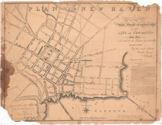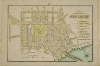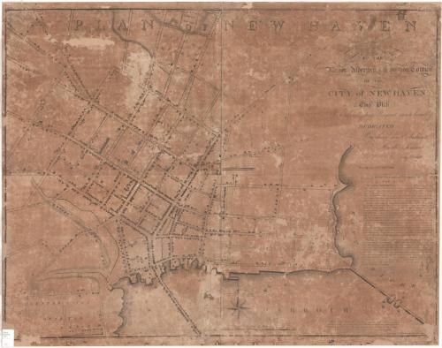
Plan of New Haven
SurveyorSurveyed by
Amos Doolittle
(American, 1754 - 1832)
PrintmakerEngraved by
Amos Doolittle
(American, 1754 - 1832)
PublisherPublished by
Amos Doolittle
(American, 1754 - 1832)
Date1812
MediumEngraving; black printer's ink on wove paper, lined with tissue paper
DimensionsPrimary Dimensions (image height x width): 28 1/4 x 36 5/8in. (71.8 x 93cm)
Sheet (height x width): 29 1/4 x 36 7/8in. (74.3 x 93.7cm)
Mount (height x width): 29 1/4 x 37in. (74.3 x 94cm)
Sheet (height x width): 29 1/4 x 36 7/8in. (74.3 x 93.7cm)
Mount (height x width): 29 1/4 x 37in. (74.3 x 94cm)
ClassificationsGraphics
Credit LineConnecticut Museum of Culture and History collection
DescriptionMap of the town of New Haven, Connecticut, focusing on the town green and its surrounding blocks, with Temple Square to the north, the East River to the east, the harbor to the south, and Howe Street to the west. In the public square, the State House, two meeting houses and the Old Burying Ground are shown. Yale College is pictured above College Street. Dwellings and shops are represented with drawings of buildings and are not labeled. Other notable landmarks include the new burying ground, public well, county jail, bell foundry, rope walks, and Tomlinson's Bridge. Boats are depicted in the harbor and along the Union or Long Wharf. On the right side is a written geographical description of the city.
Object number2005.193.0
NotesCartographic Note: Scale: 5/8 inch equals 10 rodsOn View
Not on view