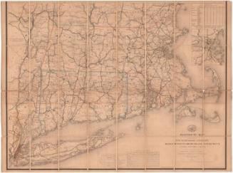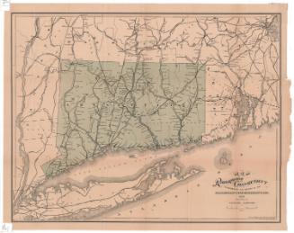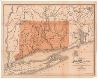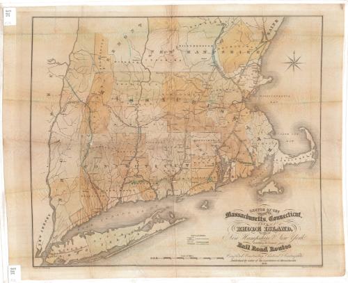
Sketch of the States of Massachusetts, Connecticut, and Rhode Island, and Parts of New Hampshire and New York
DraftsmanDrawn by
Archibald Kennedy
PrintmakerEngraved by
Morse & Tuttle
(American, 1837 - 1860)
Date1838
MediumEngraving; black printer's ink and watercolor on wove paper
DimensionsPrimary Dimensions (image height x width): 17 3/4 x 20 3/8in. (45.1 x 51.8cm)
Platemark (height x width): 18 1/4 x 21 5/8in. (46.4 x 54.9cm)
Sheet (height x width): 19 1/4 x 23 5/8in. (48.9 x 60cm)
Platemark (height x width): 18 1/4 x 21 5/8in. (46.4 x 54.9cm)
Sheet (height x width): 19 1/4 x 23 5/8in. (48.9 x 60cm)
ClassificationsGraphics
Credit LineGift of Edgar T. Welles
DescriptionMap of Massachusetts, Connecticut and Rhode Island, with parts of Vermont, New Hampshire and Maine to the north, the Massachusetts Bay to the east, Long Island and the Long Island Sound to the south, and part of New York to the west. The map prominently shows the completed and constructing, chartered, and "contemplated" railroads in the area, not all of them labeled: Long Island (unlabeled); New York and New Haven (unlabeled); Housatonic; New Haven and Hartford; Hudson and Berkshire; Western; Boston and Worcester; Norwich and Borcester; Stonington; Boston and Providence; Old Colony; Fall River and New Bedford; Lowell and Nashua; Boston and Lowell; Andover Haverhill; and Eastern Railroads.
Object number1898.9.1
NotesCartographic Note: Scale: Almost 1/2 inch equals 5 milesOn View
Not on view