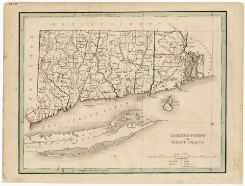
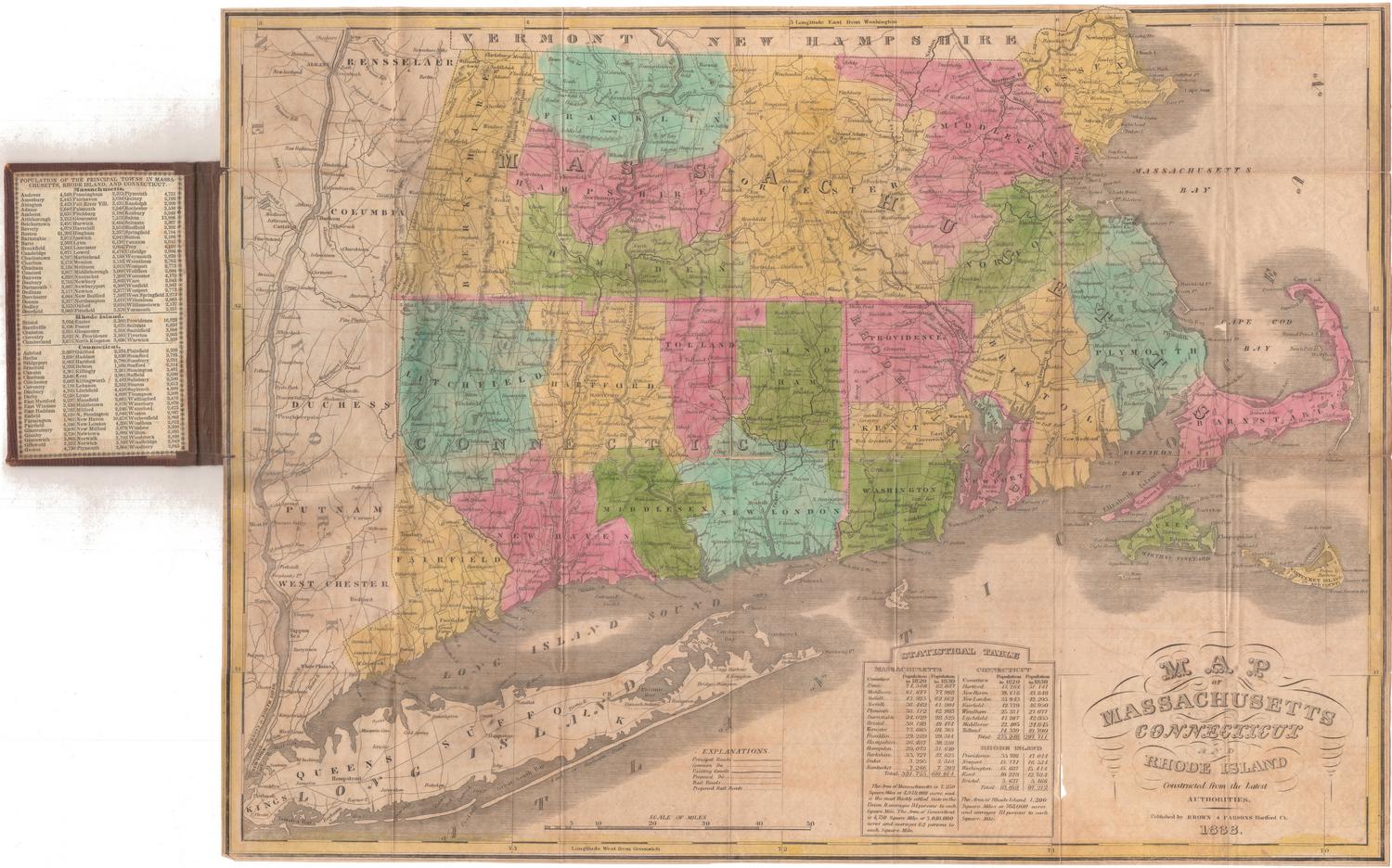
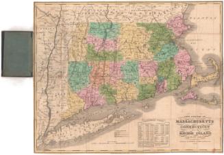
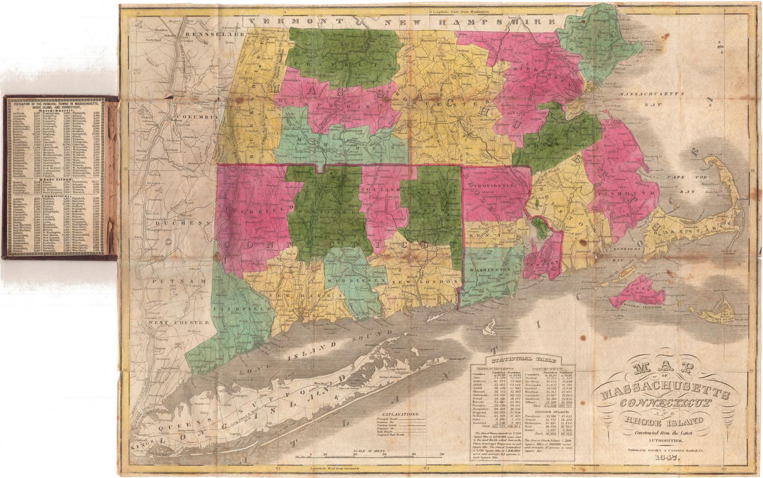
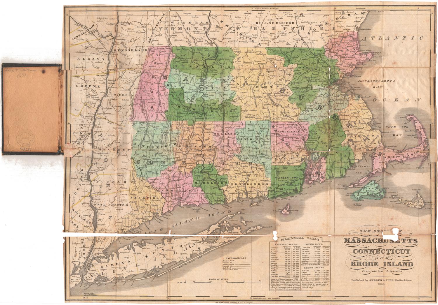
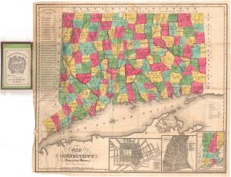
Connecticut and Rhode Island
PublisherPublished by
Thomas Gamaliel Bradford
(American, 1802 - 1887)
Date1842
MediumEngraving; black printer's ink and watercolor on wove paper
DimensionsPrimary Dimensions (image height x width): 7 7/8 x 10in. (20 x 25.4cm)
Sheet (height x width): 8 3/4 x 11 1/2in. (22.2 x 29.2cm)
ClassificationsGraphics
Credit LineMuseum purchase
Object number1946.19.2
DescriptionMap of the states of Connecticut and Rhode Island, with the borders of Massachusetts to the north and east, Long Island and the Long Island Sound to the south, and New York to the west. Connecticut is outlined in red and Rhode Island in green, with the opposite color used to outline the counties in each state. Hartford and New Haven are both marked as capital cities, with a black-and-white line between them that might indicate a railroad. A similar line indicates the Housatonic Railroad; and in eastern Connecticut, what is probably the Norwich and Westerly Railroad line is depicted. A fourth line depicts what is probably the Stonington Line of the New York, New Haven and Hartford Railroad, between Stonington, Connecticut, and Providence, Rhode Island. The Farmington and Blackstone Canals are both shown. In the northwest corner of Connecticut, there is a proposed canal that at least partially surrounds Salisbury. Physical features include elevation, conveyed through hachure marks, and rivers and lakes are shown.
Label TextThis map is an updated version of a map originally published in 1835. In just seven years, no fewer than four new railroads have been added: the Stonington and Providence, completed in 1837; the Hartford and New Haven, completed in 1839; the Norwich and Worcester, completed in 1840; and the Housatonic, which was still under construction but which had reached the Massachusetts state line by 1842. This rapid rate of change meant good business for mapmakers, who were obliged to constantly update their maps.
NotesCartographic Note: Scale: About 5/8 inches equals 10 milesStatus
Not on view


Object/Object