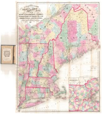
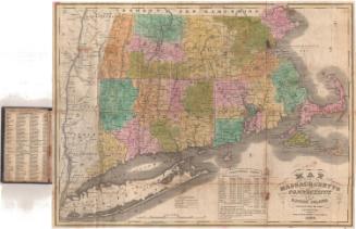
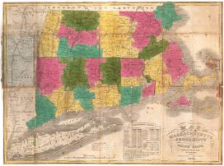
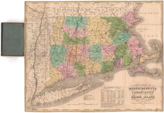
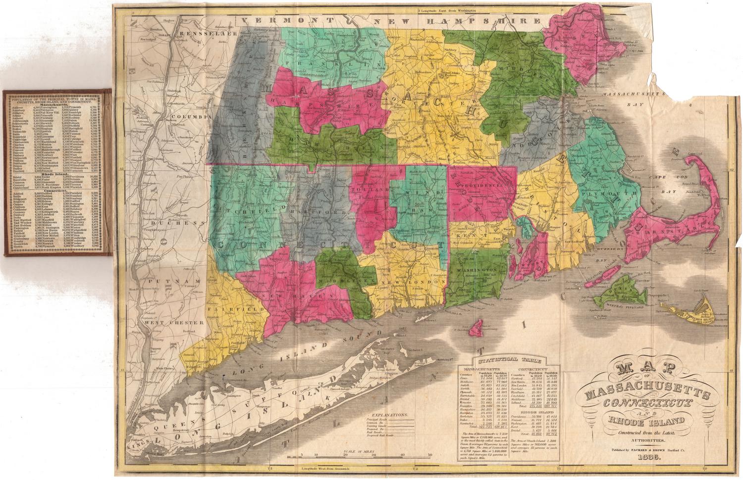
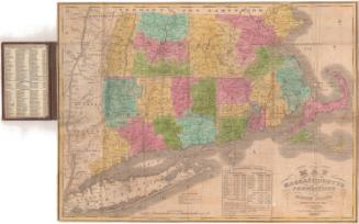
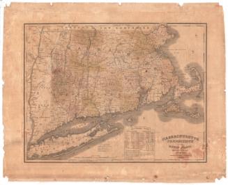
Map of Massachusetts Connecticut and Rhode Island
PublisherPublished by
Samuel Augustus Mitchell
(1792 - 1868)
Date1847
MediumLithography; black printer's ink and watercolor on wove paper
DimensionsPrimary Dimensions (image height x width): 17 1/4 x 21 3/4in. (43.8 x 55.2cm)
Sheet (height x width): 20 3/8 x 22 7/8in. (51.8 x 58.1cm)
ClassificationsGraphics
Credit LineMuseum purchase
Object number1959.114.1
DescriptionMap of Massachusetts, Connecticut and Rhode Island, with Vermont and New Hampshire to the north, the Atlantic Ocean to the east, Long Island and the Long Island Sound to the south, and New York to the west. Counties are delineated with broken solid lines and are colored pink, yellow or green. Towns are delineated with thin dotted lines. Smaller cities are marked with open circles and larger ones with closed circles. An inset map of Boston appears to the left of the cartouche, showing the locations of 20 notable buildings; various public buildings; and places of worship. Various methods of transportation are depicted, including principal roads, common roads, existing canals, proposed canals, railroads and proposed railroads.
The railroads shown include the New York and New Haven (existing); Hudson River (proposed); New York and Harlem (proposed); Albany and Stockbridge (existing); Housatonic (existing); Western (existing); New York and Boston (proposed); New Haven and Springfield (existing); what is probably the New London, Willimantic and Palmer (proposed); Norwich and Worcester (existing); Stonington (existing); Worcester (existing); Vermont and Massachusetts (existing); Fitchburg (existing); Boston and Lowell (existing); Boston and Maine (existing); Old Colony (existing); Fall River (existing); and Eastern (existing). The Farmington; Hampshire and Hampden; and Blackstone are the existing canals shown. A proposed canal leading to Taunton, Massachusetts, is also depicted.
Physical features depicted include elevation, conveyed with clusters of peaks; lakes; and islands.
Label TextSamuel Augustus Mitchell was born in Bristol, Connecticut in 1792, the son of a Scottish immigrant. After teaching for several years and finding the existing geography texts inadequate, Mitchell moved to Philadelphia, an increasingly important center of map printing and publishing, and began writing and publishing textbooks, maps, and atlases. In 1846, he acquired the rights to H. S. Tanner's New Universal Atlas, and began issuing it under his own imprint. This map of Massachusetts, Connecticut and Rhode Island is directly based on one of the copperplate engravings in that atlas. While Tanner had continued to use the older technology of copperplate engraving, however, Mitchell turned to the newer technique of lithography; the maps in his atlas are transfer lithographs. This made them substantially less expensive to produce and meant that the atlas could be sold for a cheaper price.
NotesCartographic Note: Scale, main map: 1 inch equals about 5 1/2 miles; scale, inset map of Boston: 1/4 inch equals about 550 feetStatus
Not on view


H. F. Sumner & Co.
1833