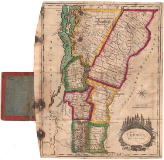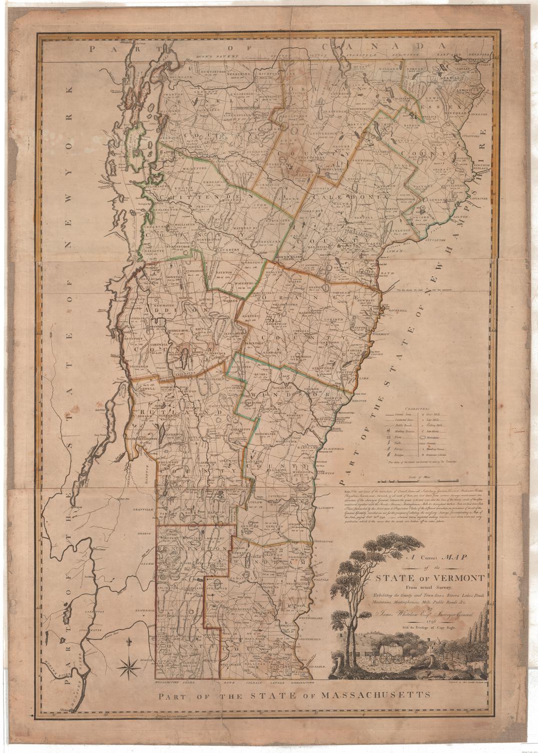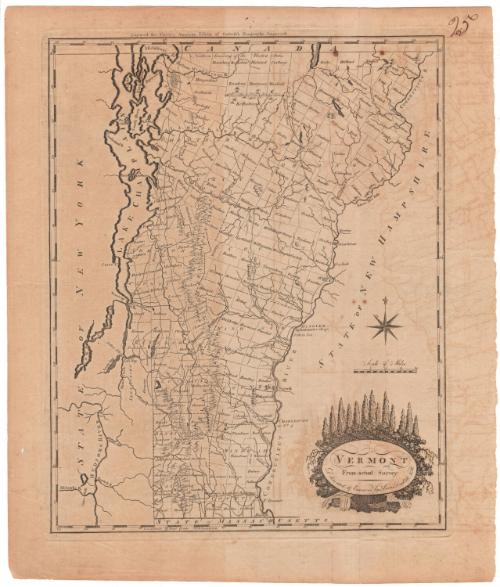
Vermont from Actual Survey
DraftsmanDrawn by
Amos Doolittle
(American, 1754 - 1832)
PrintmakerEngraved by
Amos Doolittle
(American, 1754 - 1832)
PublisherPublished by
Mathew Carey
(American, 1760 - 1839)
Date1795
MediumEngraving; printer's ink on wove paper
DimensionsPrimary Dimensions (image height x width): 14 7/8 x 11 3/4in. (37.8 x 29.8cm)
Platemark (height x width): 15 1/4 x 11 7/8in. (38.7 x 30.2cm)
Sheet (height x width): 17 1/4 x 14 5/8in. (43.8 x 37.1cm)
Platemark (height x width): 15 1/4 x 11 7/8in. (38.7 x 30.2cm)
Sheet (height x width): 17 1/4 x 14 5/8in. (43.8 x 37.1cm)
ClassificationsGraphics
Credit LineMuseum purchase
DescriptionMap of Vermont with the state of New York to the west, Canada to the north, the state of New Hampshire to the east, and the state of Massachusetts to the south. Town and county boundaries are shown, major rivers and lakes are identified, some roads are shown. Mountains are realistically depicted as ranges of peaks. An eight-point compass rose is at the right, above a scale of miles and and an elaborate cartouche with the text in an oval surmounted by evergreen trees and dense foliage, with a rushing stream at the bottom.
Object number1911.8.1
NotesCartographic Note: 1 inch = ca. 11 milesOn View
Not on view