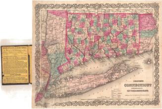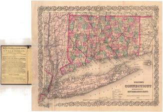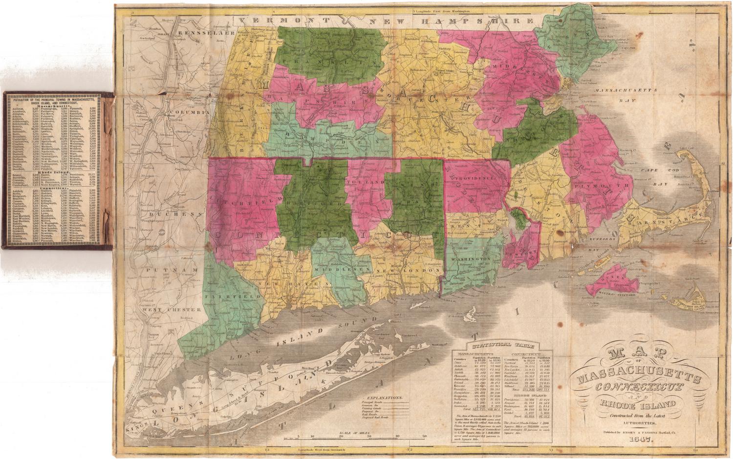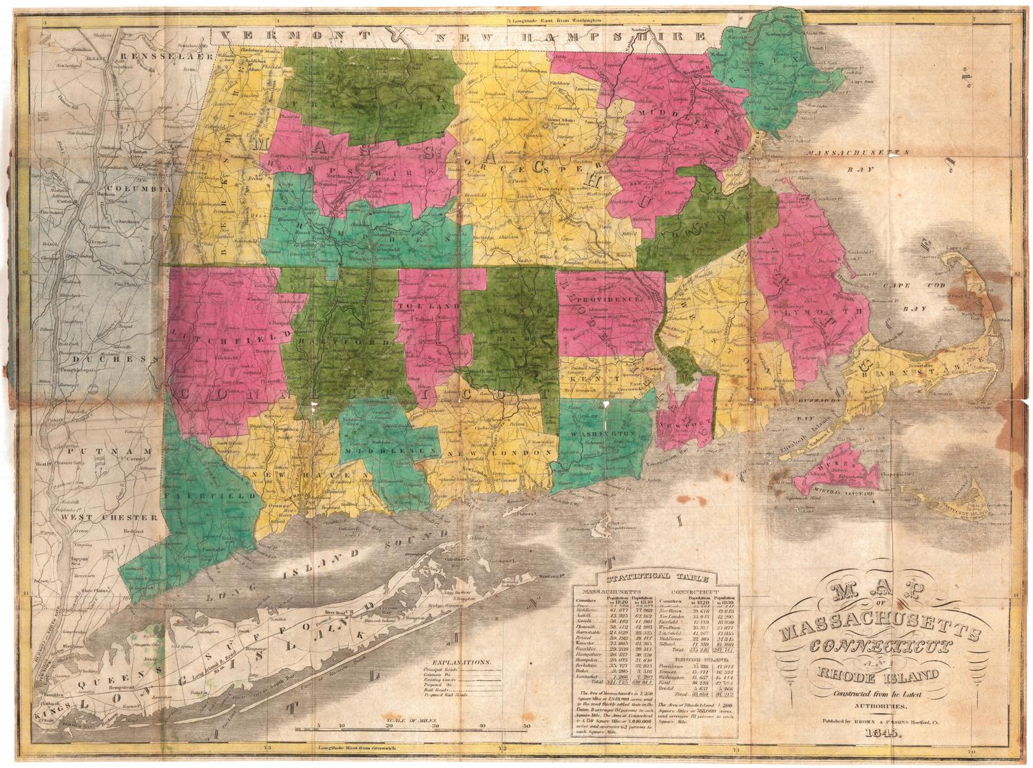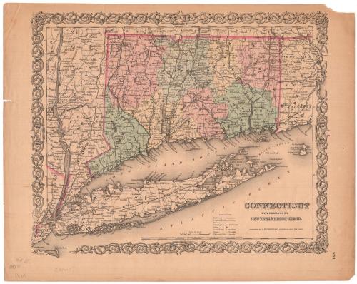
Conneticut with Portions of New York and Rhode Island
PublisherPublished by
J. H. Colton & Co.
(American, founded 1831)
Date1855
MediumLithography; black printer's ink and watercolor on wove paper
DimensionsPrimary Dimensions (image height x width): 12 3/4 x 15 1/2in. (32.4 x 39.4cm)
Sheet (height x width): 14 5/8 x 18 3/8in. (37.1 x 46.7cm)
ClassificationsGraphics
Credit LineConnecticut Museum of Culture and History collection
Object number2006.138.0
DescriptionMap of Connecticut with Long Island and the eastern portion of New York State, and the western portion of Rhode Island. The borders of all three states are colored dark pink, but only Connecticut's counties are colored (pink, blue, yellow and green). The names of the states' counties are printed in capital letters. Connecticut is further divided into towns. Cities are represented by open circles for towns and closed circles within circles for county towns. Villages are represented with open circles and are labeled in italics. Railroads and common roads are depicted with different lines. The Long Island; New York and Harlem; Hudson; New York and New Haven; Housatonic; Naugatuck; New Haven and Northampton; Hartford, Providence and Fishkill; New Haven, Hartford and Springfield; New London, Willimantic and Palmer; and Stonington and Providence Railroads are the lines shown on the map. The explanation at the bottom of the sheet has an entry for canals, although the area where showing the line used to indicate canals is blank. Elevation is conveyed through hachure marks.
Label TextThis attractive map was included in Colton's Advertising Atlas of America, published in New York in 1857. The atlas included full-page advertisements, primarily from New York businesses, interspersed throughout. The advertisers paid the publisher for these ads, covering the cost of producing the atlases, which were then distributed to hotels and steamships for perusal by their guests.
NotesCartographic Note: Scale: 1/2 inch equals 5 milesStatus
Not on view