To the Honl. Jno. Hancock, Esqre, President of Ye Continental Congress, This Map of the Seat of Civil War in America is Respectfully Inscribed
DraftsmanDrawn by
Bernard Romans
(American, 1741 - 1784)
Date1775
MediumEngraving; printer's ink on wove paper
DimensionsPrimary Dimensions (image height x width): 15 3/8 x 17 1/4in. (39.1 x 43.8cm)
Platemark (height x width): 15 3/4 x 17 7/8in. (40 x 45.4cm)
Sheet (height x width): 16 5/8 x 21 1/4in. (42.2 x 54cm)
ClassificationsGraphics
Credit LineCrofut Acquisitions Fund
Object number1988.212.0
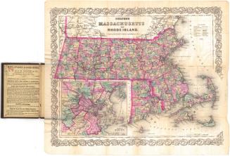
DescriptionMap of eastern Massachusetts as far north as Beverly, Chelmsford, and Leominster. Part of Connecticut, including the towns of Killingly, Pomfret, and Voluntown, is to the west. Buzzard's Bay and part of the Colony of Rhode Island are to the south. Boston Harbor and the Atlantic Ocean are to the east. Towns, rivers, ponds, and hills are identified. A small inset map shows a "Plan of Boston and its Environs," including the location of "Provincial Lines" "Enemy Lines" and redoubts. A small landscape at lower right shows "A View of the Lines Thrown upon BOSTON NECK by the Ministerial Army."
Label TextMapmaker Bernard Romans clearly proclaims his allegiance to the American cause in the inscriptions on his Map of the Seat of Civil War in America. The map is dedicated to John Hancock, President of the Continental Congress, and refers to the British as the "Enemy." Born, in Holland, Romans had come to North America in the service of the British army. Romans' map is a snapshot from the early days of the American Revolution, when action was largely limited to the area surrounding Boston. His inclusion of a small part of the Colony of Connecticut at the far left, suggests just how close Connecticut, and especially Windham County, was to the scene of action.
NotesCartographic Note:Status
Not on viewKellogg & Bulkeley
1910-1915


