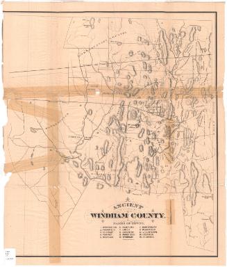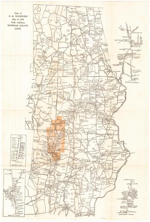
Copy of E. M. Woodford map of 1856 with Additions
DraftsmanDrawn by
Unknown
After a work byAfter a work by
E. M. Woodford
(American, 1824 - 1862)
PrinterPrinted by
Unknown
Date1928
MediumLithography; black printer's ink on wove paper
DimensionsPrimary Dimensions (image height x width): 28 3/4 x 19in. (73 x 48.3cm)
Sheet (height x width): 29 3/4 x 20 1/4in. (75.6 x 51.4cm)
Sheet (height x width): 29 3/4 x 20 1/4in. (75.6 x 51.4cm)
ClassificationsGraphics
Credit LineMuseum purchase
DescriptionMap of Windham County, Connecticut. The Massachusetts border, not identified, is to the north. The Quinebaug River is to the east. Towns include Woodstock, Eastford, Pomfret, Hampton, Brooklyn, and Canterbury. Small inset maps include "Ancient Map of Abington," "Hampton Hill," "Brooklyn Center," and "Old Pomfret Village." Names of property owners are shown and some businesses are indicated, including inns, taverns, schools, court houses, blacksmith shops, and sword repair shop. Roads include "Original Road in 1786 - Turnpike Laid out / in 1800," "Nipmunk Path," and "Original Layout of King's Highway." The location of an Indian battle ground is indicated. Rivers, streams, ponds, lakes, and some hills are shown. Elevation is indicated using hachure marks.
Object number2006.137.0
NotesCartographic Note: No scale
Date Note: Date is from old record; source of date is not clear.On View
Not on view