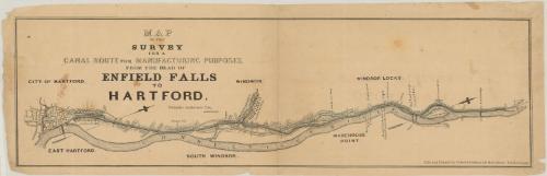
Map of the Survey for a Canal Route for Manufacturing Purposes from the Head of Enfield Falls to Hartford
DraftsmanDrawn by
Philander Anderson
(1810 - 1853)
PrinterPrinted by
Colton & Colburn
(American, 1840 - 1848)
Date1847
MediumLithography; black printer's ink and watercolor on wove paper
DimensionsPrimary Dimensions (image height x width): 7 1/8 x 24 7/8in. (18.1 x 63.2cm)
Sheet (height x width): 8 1/4 x 26 1/4in. (21 x 66.7cm)
Sheet (height x width): 8 1/4 x 26 1/4in. (21 x 66.7cm)
ClassificationsGraphics
Credit LineGift of Frank F. Starr
DescriptionMap of the Connecticut River and adjoining areas showing a proposed canal from Windsor Locks to Hartford. The map is oriented with south on the left and north on the right; this is indicated by two compasses. Towns shown include Hartford, East Hartford, Windsor, South Windsor, Windsor Locks, and Warehouse Point. In addition to the Connecticut River, the Mill (Park) River, the Farmington River, Pine Meadow Brook, Haskell's Brook, and Pease's Brook. Other geographical features include King's Island, Stoney Hill. and the Enfield Falls or Rapids. The New Haven, Hartford and Springfield Railroad is shown, with depots at Hartford, Windsor, Windsor Locks and Warehouse Point. Also shown are the Enfield bridge, the Hartford covered bridge, a railroad bridge, a proposed dam, a proposed reservoir, Carleton's Basin, Perse & Brooks paper mill, Slate & Brown's machine shop, Ripley's iron works, silk factory, and wire factory. Two large mill proposed mill complexes are indicated in Hartford and Windsor.
Object number1894.24.1
NotesCartographic Note: No scaleOn View
Not on view

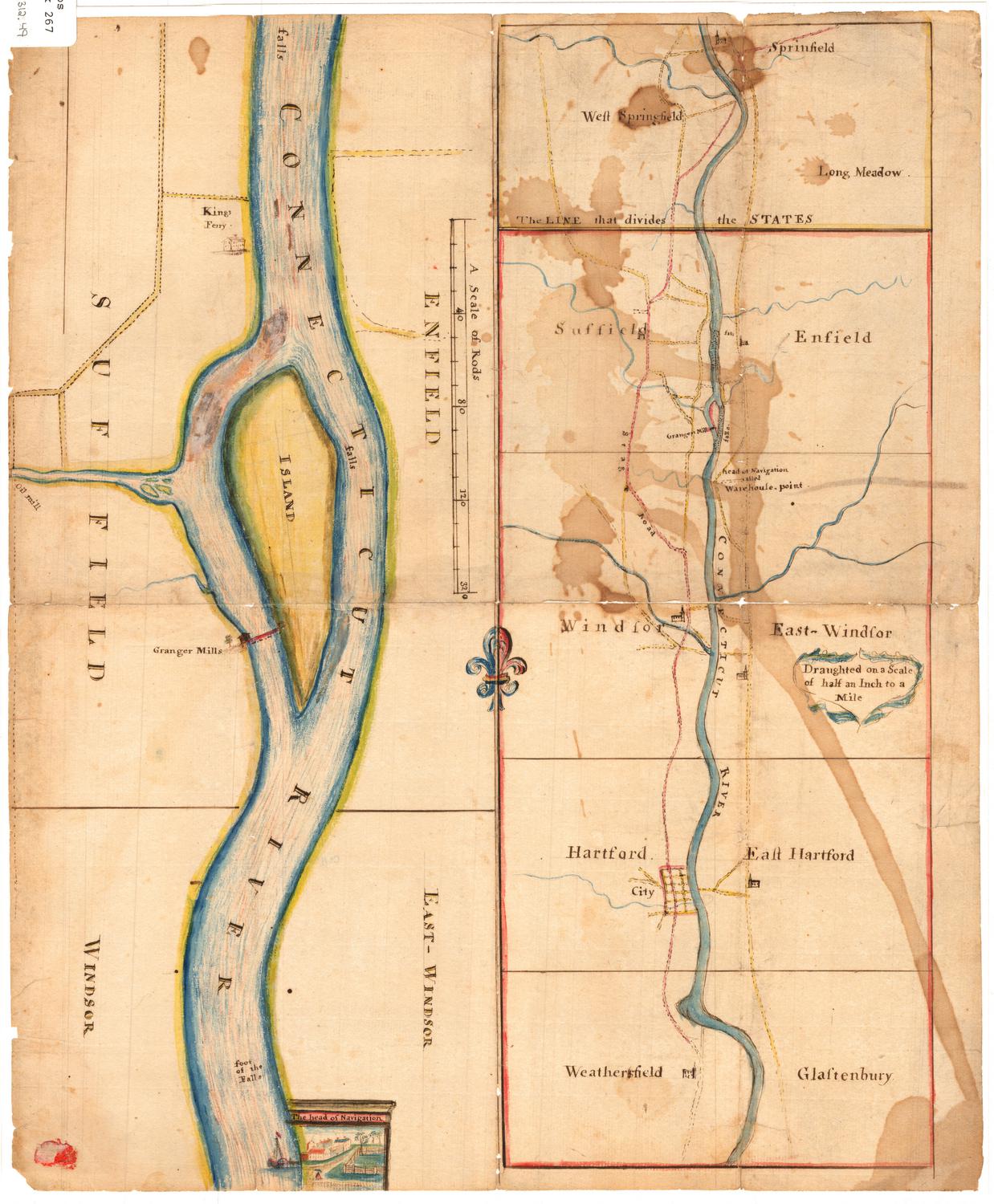
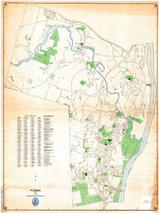
George E. Allen