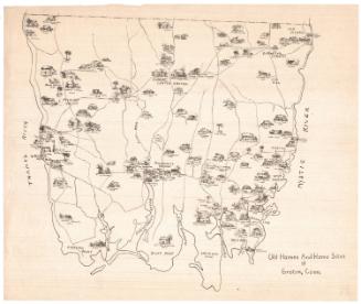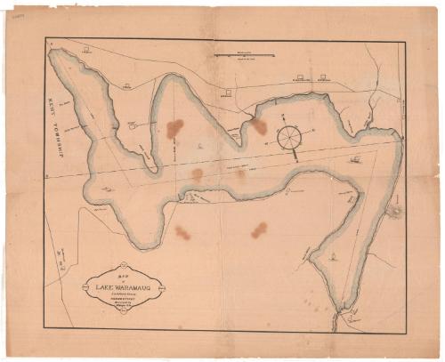
Map of Lake Waramaug, Litchfield County, Connecticut
PrinterPrinted by
W. Hager & Co.
(American)
Date1875
MediumLithography; black printer's ink and watercolor on wove paper
DimensionsPrimary Dimensions (image height x width): 13 3/4 x 17 1/4in. (34.9 x 43.8cm)
Sheet (height x width): 16 5/8 x 20 1/2in. (42.2 x 52.1cm)
Sheet (height x width): 16 5/8 x 20 1/2in. (42.2 x 52.1cm)
ClassificationsGraphics
Credit LineGift of Marjorie S. Turner
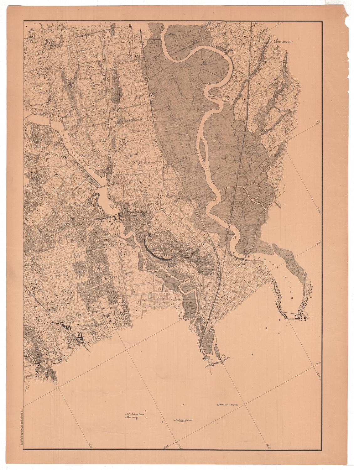
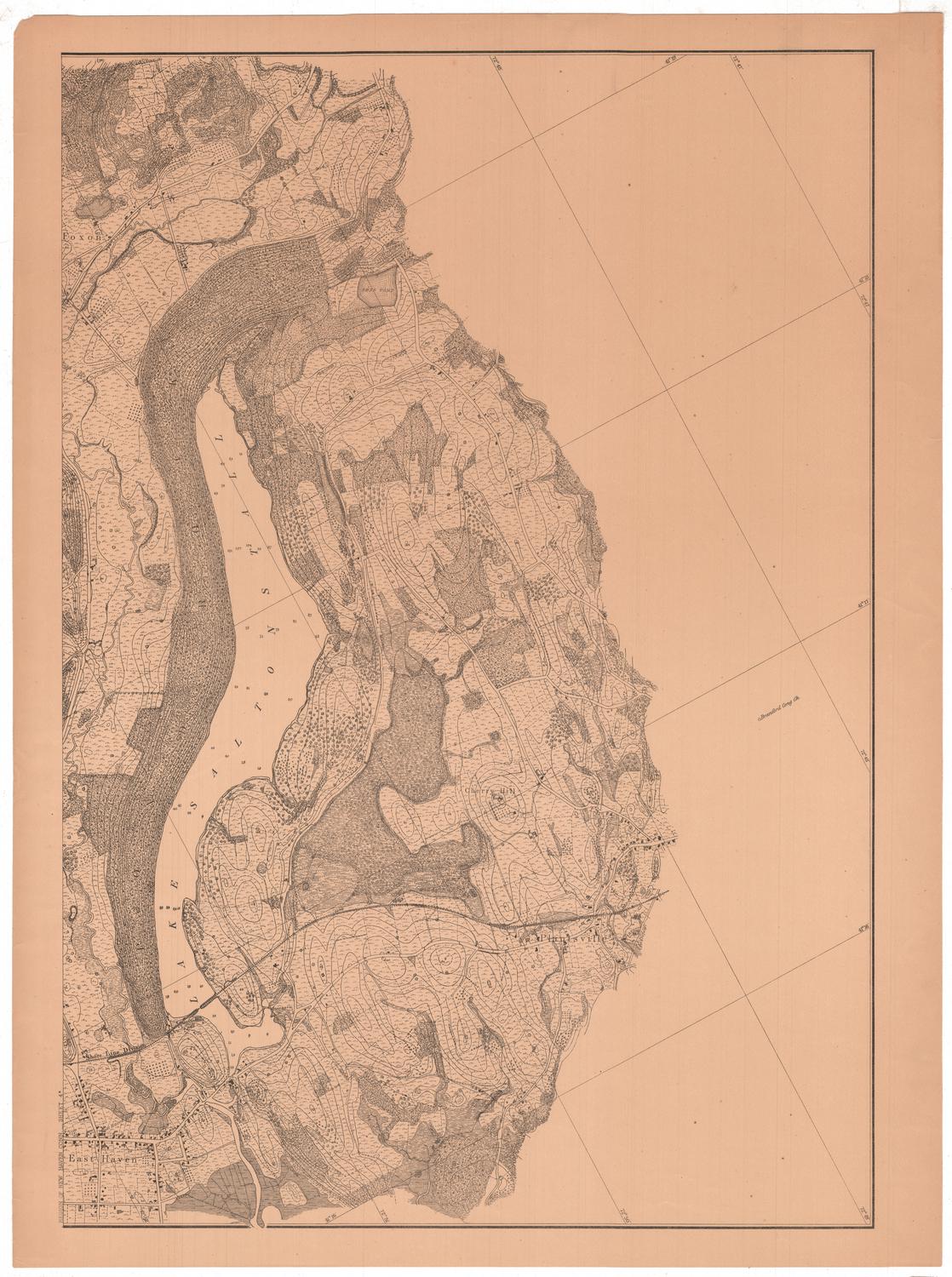
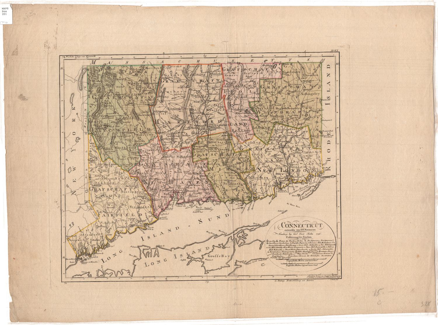
DescriptionMap of Lake Waramaug in Litchfield County, Connecticut. The width of the lake in various spots is measured in feet, as is the length. Sucker Brook is visible in the northeast corner. Solid lines appear to indicate roads, and rectangles along the roads probably indicate houses or other buildings. They are labeled with what are presumably the owners' names. Next to Hawes Point on the north side of the lake is a smoker camp, while next to Point Beautiful on the south side of the lake is a gunnery camp. Canoes, a sailboat, and a steamship are depicted on the lake's surface.
Object number1960.139.1
NotesCartographic Note: Scale: 1 inch equals 700 feetOn View
Not on view