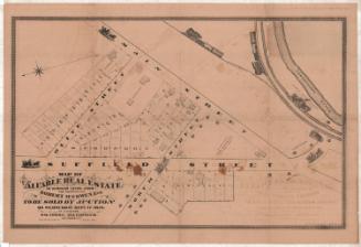
Map of Valuable Building Lots Situated on Main Street Continued
SurveyorSurveyed by
Unknown
DraftsmanDrawn by
Unknown
PrinterPrinted by
Unknown
Date1852
MediumLithography; black printer's ink on wove paper
DimensionsPrimary Dimensions (image height x width): 28 1/4 x 22 7/8in. (71.8 x 58.1cm)
Sheet (height x width): 39 3/8 x 25 3/4in. (100 x 65.4cm)
Sheet (height x width): 39 3/8 x 25 3/4in. (100 x 65.4cm)
ClassificationsGraphics
Credit LineGift of Leslie T. Goodrich
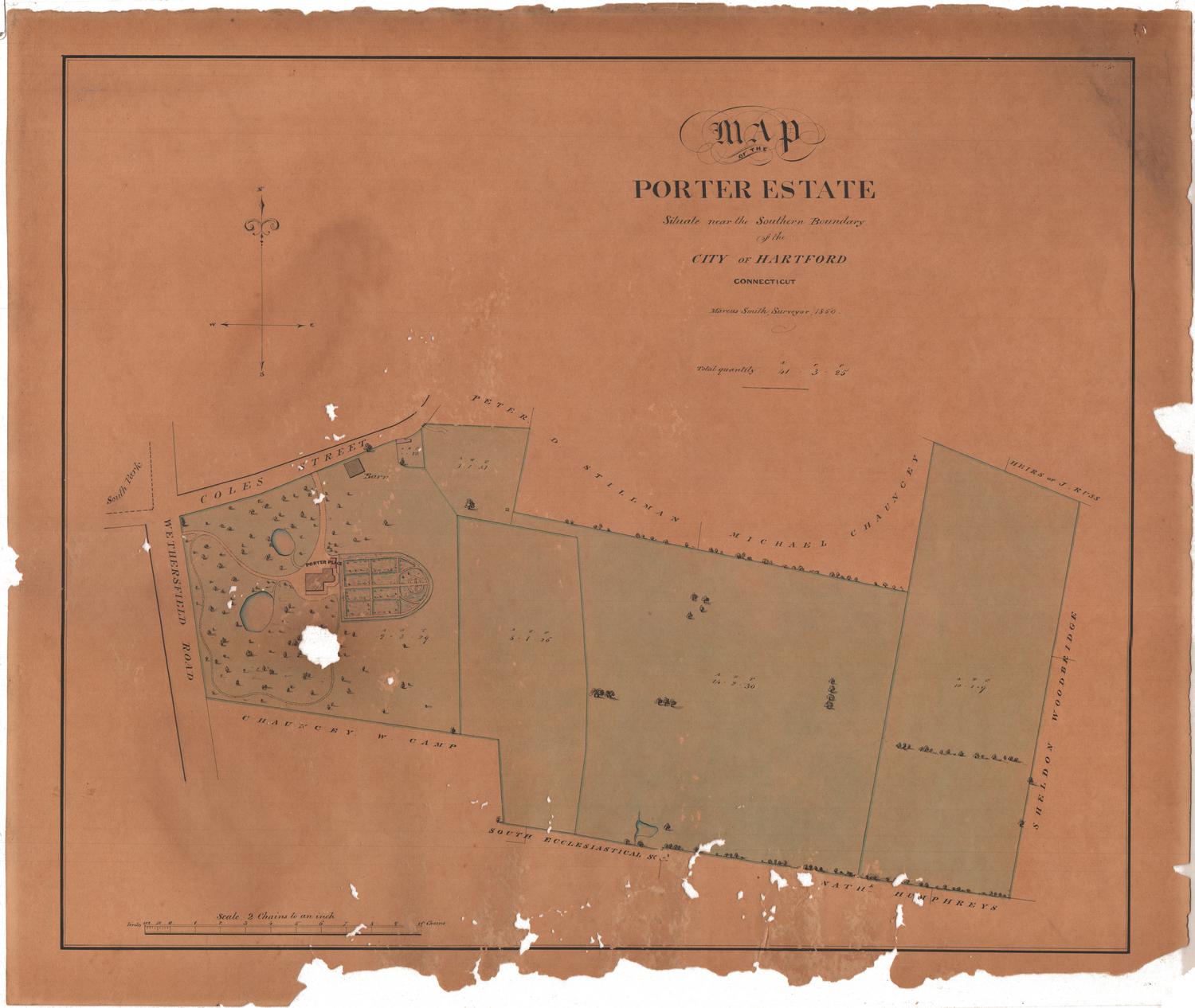
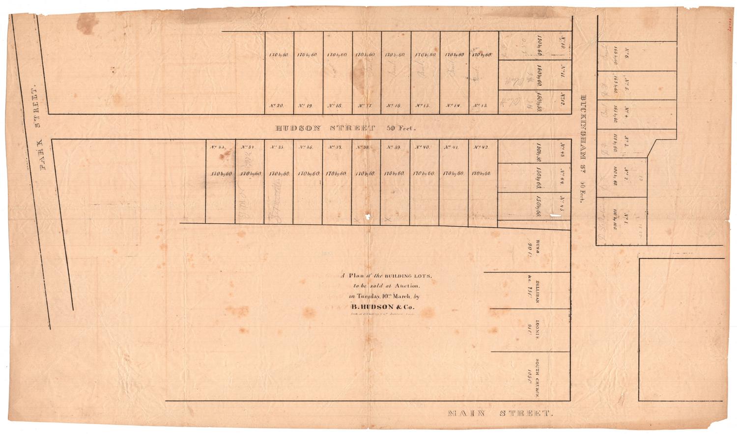
DescriptionMap of building lots in Hartford, Connecticut, along Front and Main Streets, with South Street running perpendicular. The lots are numbered from 1-56 and the lengths in feet are given. On lot 4 is "Never failing Water," and on lot 6 is a barn. The lots are bounded on one side by land belonging to the South Ecclesiastical Society and on the other by land belonging to Richard G. Drake.
Object number1946.18.0
NotesCartographic Note: No scale
Constituent Note: The map was probably printed by either E.B. & E.C. Kellogg or by Case & Green, the two major lithography firms active in Hartford in the early 1850s.On View
Not on view
D. W. Kellogg & Co.
1830-1840

