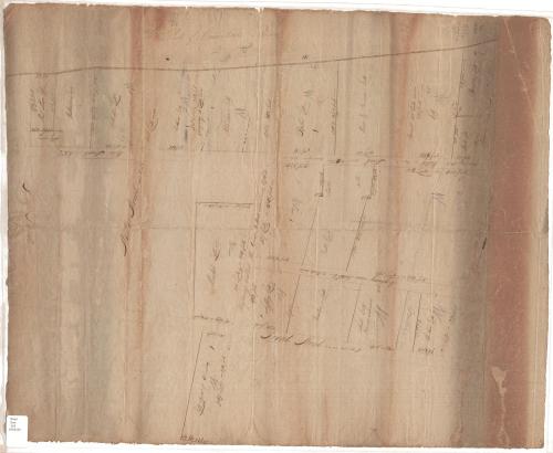
Streets and lots below State Street, Hartford, Connecticut
SurveyorSurveyed by
Unknown
DraftsmanDrawn by
Unknown
DatePossibly 1800
MediumDrawing; brown ink on wove paper
DimensionsPrimary Dimensions (image height x width): 25 1/4 x 20 1/2in. (64.1 x 52.1cm)
Sheet (height x width): 25 1/4 x 20 1/2in. (64.1 x 52.1cm)
Sheet (height x width): 25 1/4 x 20 1/2in. (64.1 x 52.1cm)
ClassificationsGraphics
Credit LineConnecticut Museum of Culture and History collection
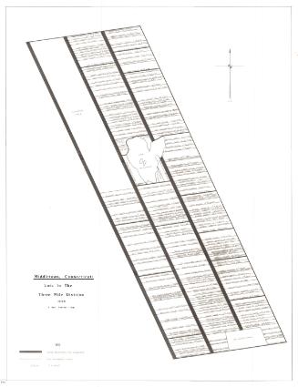
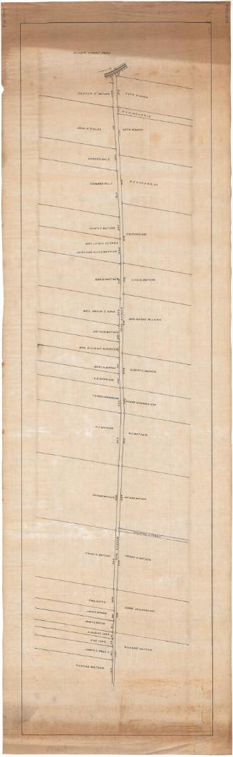
DescriptionManuscript map of part of the Connecticut River waterfront in Hartford, Connecticut. The streets are lined with land lots, which are labeled with the owner's name or a description of the building that stood there ("blue house"). The lots contain geographic coordinates and distance measurements in links and feet. Streets include Front Street, Ferry Street, State Street, Water Street, the "Highway called the Grove" (Grove Street), and the "highway runs north" (Commerce Street?). Property owners include Watkinson, Perkins, Bull, Ware & Brown, and Benslow or Denslow. Also shown are the Hart store, Colt's store, and market lots.
Object number2006.134.0
NotesCartographic Note: No scaleOn View
Not on view


D. W. Kellogg & Co.
1830-1840