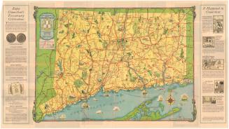
Hartford
After a work byAfter a work by
Defense Mapping Agency
(American, founded 1972)
After a work byAfter a work by
United States Army Topogaphic Command
(American, 1968 - 1973)
PrinterProbably printed by
Colorgraphics
(American, founded 1976)
Dateafter 1976
MediumOffset lithography; black and colored printer's inks on plastic
DimensionsPrimary Dimensions (image height x width): 17 5/8 x 26 1/2in. (44.8 x 67.3cm)
Sheet (height x width): 20 3/4 x 31in. (52.7 x 78.7cm)
ClassificationsGraphics
Credit LineGift of Ursula Korzenik
Object number2004.142.5
DescriptionRaised relief map of most of Connecticut, excluding the portion of the state east of Norwich, and part of New York State. Contour lines and relief are used to convey elevation. Cities' names appear in text that varies in size according to population. Yellow is presumably used to denote populated areas. Roads are shown, with different lines used to indicate whether they are primary or secondary roads and their surface quality.
Label TextIt is unclear why this map was produced except as a curiosity. The use of a plastic support allowed the depiction of Connecticut's topography in three-dimensions. While this is interesting, it is hardly very useful, except perhaps to the vison-impaired. While the map was probably produced sometime in the late 1970s, much of the data on which it was based, including aerial surveys, was compiled by United States Army mapping agencies during the 1940s, 1950s, and 1960s. According to an inscription, the roads and highways are shown as they existed in 1974. The amount of detail incorporated into the map makes it hard to read.
NotesCartographic Note: Scale: 1:250,000Constituent Note: The United States Army Map Service was established during World War II to facilitate the production of military maps with minimal fieldwork. In 1968, the Army Map Service became the United States Army Topographic Command, and in 1972, it became part of the Defense Map Agency.
Status
Not on view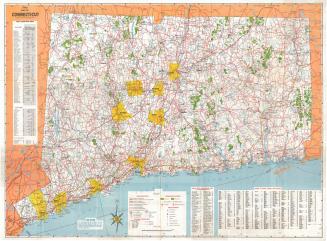


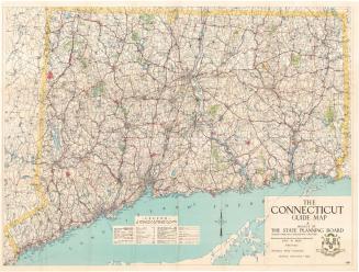
Connecticut State Highway Department
1923