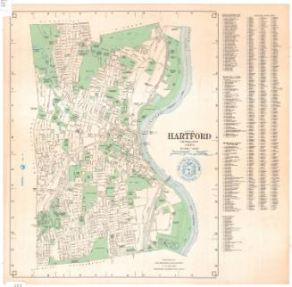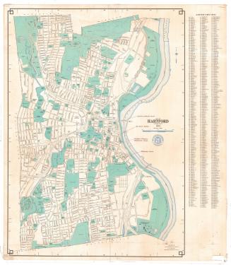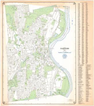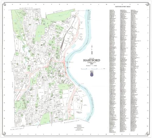
City of Hartford, Connecticut
MakerPrepared by
Metropolitan District Commission
(American, founded 1929)
Date1997
MediumLithography; black and colored printer's inks on wove paper
DimensionsPrimary Dimensions (image height x width): 23 x 25in. (58.4 x 63.5cm)
Sheet (height x width): 24 3/8 x 25 1/2in. (61.9 x 64.8cm)
ClassificationsGraphics
Credit LineGift of Ursula Korzenik
Object number2004.142.4
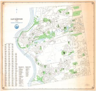
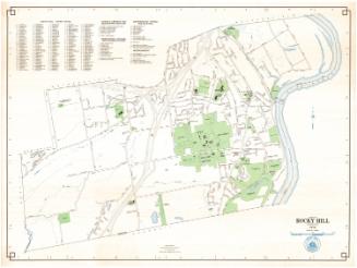
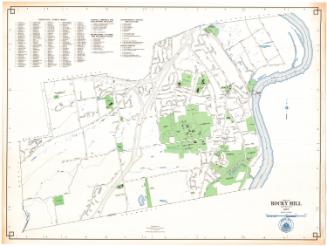
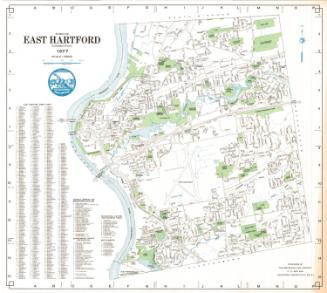
DescriptionMap of Hartford, Connecticut, with Bloomfield and Windsor to the north, the Connecticut River to the east, Newington and Wethersfield to the south, and West Hartford to the west. Local roads are labeled; and parks, hospitals, schools and universities, civic buildings and other public spaces are colored green. Ponds, rivers and other bodies of water are blue. The interstate highways are shown in red. To the right of the map is a street index.
Label TextThe Metropolitan District Commission had begun using the computer mapping technology known as GIS (for Geographic Information System) as early as 1988. This 1997 computer-generated map shows just how sophisticated the new technology had become in less than ten years. At the same time, the MDC began promoting the use of interactive electronic maps, permitting the eight towns that were members in the district to connect to their central database. Increasing amounts of information were also being made available online, where they could be accessed by residents of the member towns and by the general public. GIS has transformed the way that even ordinary people use maps; it has also greatly increased public awareness of maps and their overall usefulness.
NotesCartographic Note: Scale: 1 inch equals 1600 feetStatus
Not on view