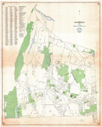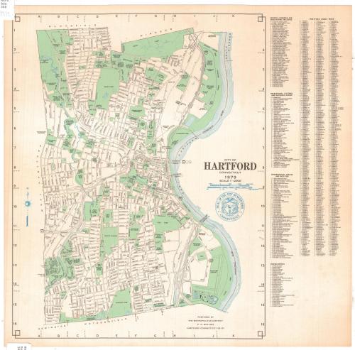
City of Hartford, Connecticut
MakerPrepared by the
Metropolitan District Commission
(American, founded 1929)
Date1979
MediumLithography; black, green and blue ink on wove paper
DimensionsPrimary Dimensions (image height x width): 16 5/8 x 13 1/16in. (42.2 x 33.2cm)
Sheet (height x width): 17 1/2 x 17 7/8in. (44.5 x 45.4cm)
ClassificationsGraphics
Credit LineGift of Ursula Korzenik
Object number2004.142.1
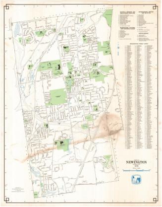
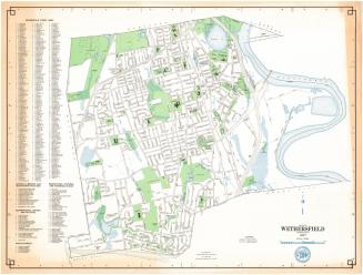
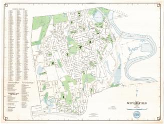
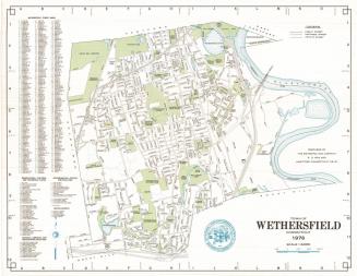
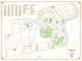
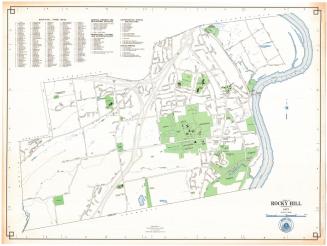
DescriptionMap of the city of Hartford, Connecticut, from Bloomfield and Windsor to the north, the Connecticut River to the east, Newington and Wethersfield to the south, and West Hartford to the west. Streets are labeled and parks, schools, cemeteries, hospitals and state buildings are shown in green. The Connecticut River, Park River and various lakes and ponds are shown in blue. The city seal is in the cartouche. To the right of the map are a street index and lists of schools, libraries and educational facilities; recreational, cultural, and historical places; governmental offices and facilities; and miscellaneous sites.
Label TextThis 1979 map of Hartford, produced by the Metropolitan District Commission, shows an impressive number of parks and open spaces. The Metropolitan District Commission had long been responsible for sewage collection and disposal as well as for the water supply of the greater Hartford area. In 1979, the MDC was authorized by the state legislature to oversee the disposal of solid waste as well. At that time, Hartford still burned its garbage at a dump in the North Meadows, which is shown on this map as a "disposal area," tucked between a Police Department Pistol Range and a Fire Department Training Area.. The MDC appears as the owner of a water treatment plant in the South Meadows, where, by the mid-1980s, the Commission would construct a regional solid waste disposal plant which would burn the area's garbage to generate electricity.
NotesCartographic Note: Scale: 1/2 inch equals 1000 feetStatus
Not on view